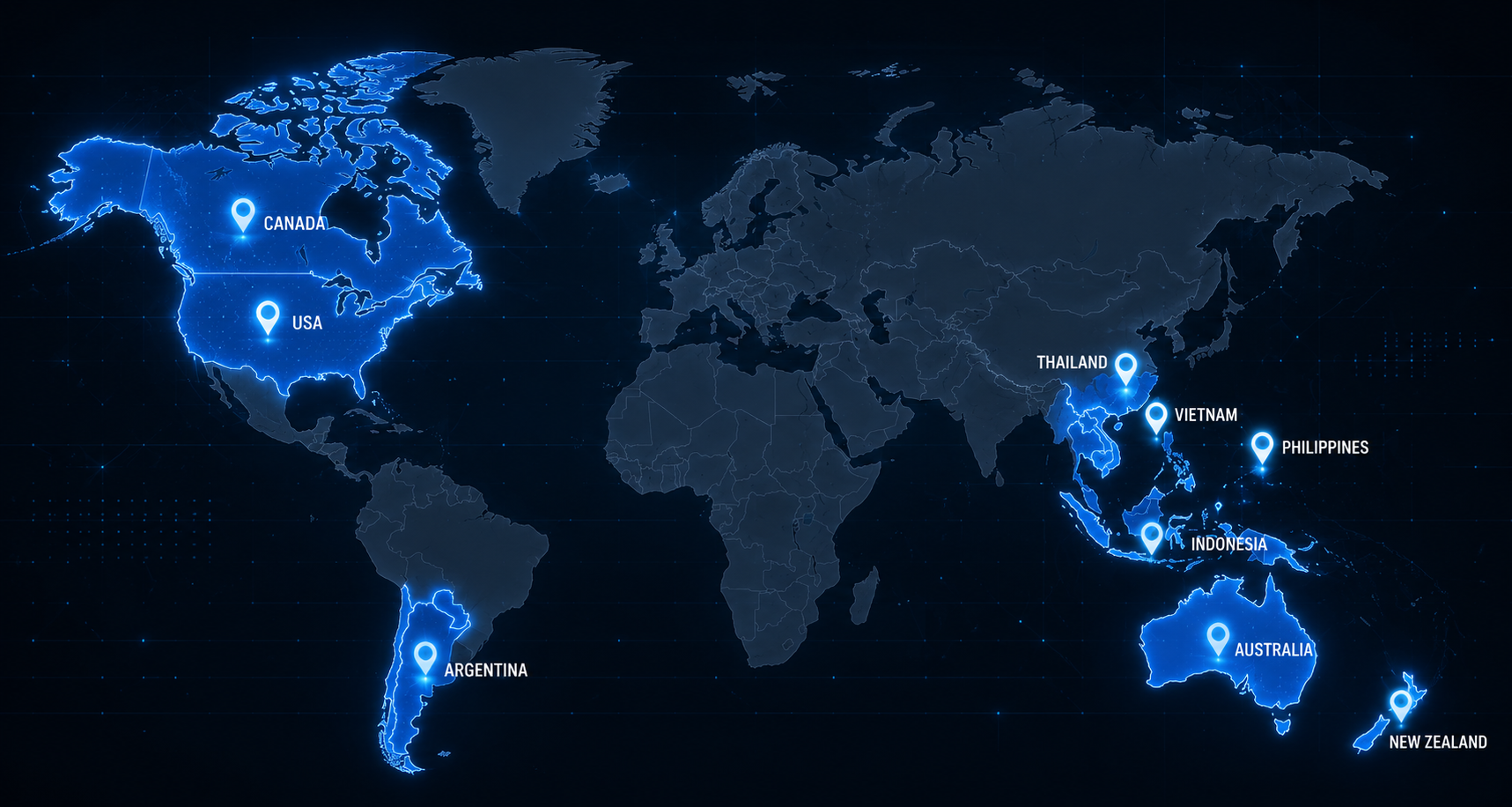
In Action
See how ReadyTakeAction supports real communities through real emergencies.
In the Field. In the Community. In Action.
ReadyTakeAction Scenario Demonstrations
Follow the scenarios based on real disaster conditions in Australia and actual ReadyTakeAction platform capabilities.

When Minutes Matter
A regional family receives personalised warnings, activates their emergency plan, evacuates before conditions deteriorate, stays connected towers fail, and begins recovery with confidence.
(5-minute read)
Six Weeks Before — Sunday Morning, Yarramalong Valley, NSW Central Coast
Sarah is making coffee when her phone buzzes.
Not an emergency alert. Just the app she downloaded after the 2019 fires scared her enough to actually do something about it.
"It's October. Fire season is 6 weeks away. Your emergency kit hasn't been reviewed since March. 4 items may need replacing."
She almost ignores it. Then she opens it.
The app has checked her kit inventory against its own shelf-life tracking. Her water purification tablets expired in July. The torch batteries are 14 months old. She has no copies of her insurance documents saved digitally. Her evacuation route — added during setup — passes through Old Pacific Highway, which now has a seasonal fire closure she didn't know about.
She spends 47 minutes on a Sunday morning fixing all four things. She photographs her insurance documents. She updates her primary evacuation route. She checks the alternate.
Her husband Mark thinks she's being anxious. He doesn't say it, but she can tell.
Six weeks later, she is not anxious. She is ready.
Day 1 — Tuesday, 11:43am
The RFS is tracking a fire that started near Mangrove Mountain at 9am. It's currently rated Watch and Act for communities north of Gosford. Yarramalong is technically south of the official zone.
Sarah's phone buzzes. Not the RFS alert. RTA.
"Fire behaviour modelling updated. Wind shift forecast at 2:15pm may push fire front toward Yarramalong Valley. Based on your property location and primary route, we recommend reviewing your departure window now. Estimated safe departure window: before 1:30pm."
She stares at it for a moment. It is 11:43am.
She calls Mark at work. He hasn't received the alert — he hasn't synced his account to the shared family profile. She reads it to him over the phone.
"The RFS hasn't said anything," he says.
"I know," she says.
She checks the RTA incident feed.
Three other Yarramalong residents have already posted. One has a photo of smoke visible from their ridge. Another has reported the smell of smoke since 10am. A third has posted that their horses are agitated — "they always know before we do."
The crowd knows something the official alert system hasn't said yet.
12:15pm — The Decision
Sarah opens the family action plan. She built it in April with the Assisted Planner. It's specific — not a generic checklist, but her plan, for her property, for her family.
The plan says:
• Alert Level: Watch and Act in adjacent zone → "Begin loading vehicle. Do not wait for official upgrade. Departure window may close before official escalation."
• Primary Route: Yarramalong Road → Wyong → M1 South → Sister's house, Epping
• Alternate Route: Dooralong Valley Road → Central Coast Highway (flagged: check road status before use)
• Animals: Two dogs, chickens — crate locations noted, estimated loading time 18 minutes
• Documents: Already uploaded to RTA secure vault — no physical collection needed
• Children: Jack is at Yarramalong Public School — "School has been notified via School Connect. Confirm pickup."
She had connected the school to their family profile during setup. The school receives her departure alert automatically. The principal has already sent a message: "We are preparing for early dismissal. Parents in the valley, please collect children now."
She didn't have to call the school. The school already knew.
12:47pm — Loading
Mark arrives home at 12:47. He sees the car half-loaded. He stops arguing. They work through the action plan together. The app runs a live checklist:
• ✅ Documents (digital vault active)
• ✅ Medications (3 days supply)
• ✅ Dogs (crated, in vehicle)
• ✅ Phone chargers
• ✅ Cash ($200 from the emergency envelope set aside during the kit review)
• ✅ Alternate accommodation confirmed — sister in Epping has replied "yes, come"
• ⚠️ Chickens — decision required
They leave the chickens. It's the right call. They know it is because the plan told them to make this decision before the emergency, not during it.
They are on the road by 1:14pm.
1:23pm — The Wind Shifts
The RFS upgrades Yarramalong Valley to Emergency Warning at 1:31pm.
Sarah and Mark are already 20 minutes clear of the valley.
Sarah's phone shows the upgrade notification. Below it, a message from ReadyTakeAction:
"Emergency Warning issued for your property address. You are marked as departed. Your emergency contact (Mark) has been notified. Family status: both safe and mobile."
Her mother in Brisbane, connected through the Family Tracker, receives an automatic notification:
"Sarah and Mark have left their property and are travelling to their designated evacuation location. They are safe."
Her mother does not need to call. She knows.
2:41pm — On the Road
The M1 is slow. Everyone leaving the coast at once.
Sarah opens the community incident feed. Real-time updates from people ahead of them and behind them:
• "Old Pacific Highway fully closed, fire crossing at Somersby — do not use" (posted 2:18pm)
• "Servo at Gosford still open, last fuel point heading south" (posted 2:29pm)
• "M1 moving well past Wahroonga — bottleneck is between Ourimbah and Gosford" (posted 2:37pm)
She shares their location status with the community:
"Yarramalong family, two adults, two dogs, heading to Epping. Road passable. Avoid Somersby."
Four people respond with thanks. One asks if they can share her route update with a neighbour who's still deciding whether to leave.
3:47pm — The Towers Fall
Sarah and Mark are 40 minutes south of Gosford. They are safe.
Back in the valley, the fire crosses the ridge at 3:31pm.
By 3:47pm, the Telstra tower at Mangrove Mountain is gone. The Optus tower follows at 4:02pm. The NBN fixed wireless that serves the valley burns through at 4:15pm.
For the 340 households still in Yarramalong Valley — those who stayed to defend, those who left it too late, those who had no vehicle — the outside world disappears.
No calls. No texts. No RFS updates. No way to tell anyone where you are or whether you are alive.
In 2019, this is where the story ended. You were on your own until a truck could physically get through.
3:47pm — But Not This Time
Three Emergency Nodes sit in the valley.
One at the Yarramalong Rural Fire Brigade shed. One at the community hall on Cedar Brush Road. One at the primary school — bolted to the roof in 2024 as part of the school's emergency preparedness upgrade.
Each node is solar-powered with a 72-hour battery backup. Each is rated to survive the conditions. Each survived the fire front.
When the towers fell, the nodes didn't notice. They were already talking to each other.
Sixty-three households in the valley have RTA on their phones. As mobile coverage dropped, their apps switched automatically to mesh mode — connecting to the nearest Emergency Node via Bluetooth and LoRa radio.
No action required by the user. No setting to change. The app found the mesh.
At 4:23pm, the first welfare check-in propagates across the network: Jim Henderson — Cedar Brush Road — Defending property. House threatened. Two adults. Safe for now.
At 4:31pm:
Robson family — Yarramalong Road — Sheltered in dam. Embers through roof. Need assistance when safe.
At 4:44pm:
Margaret Oakes — Carters Road — Confirmed safe. Neighbour (unknown name, elderly man, white ute) sheltering with her. Both okay.
These messages don't reach Sydney yet. But they reach every other mesh-connected device in the valley. People know their neighbours are alive. In the middle of a fire, that is not a small thing.
5:12pm — The Gateway Opens
The node at the school has a satellite uplink — a secondary channel that activates when terrestrial infrastructure fails completely.
At 5:12pm, it establishes a low-bandwidth connection. Not enough for voice calls. Not enough for video. Enough for structured data packets — welfare check-ins, incident reports, priority assistance flags.
The messages queued across the mesh for the past 49 minutes upload in 23 seconds.
In Gosford, the RFS operations coordinator has been staring at a welfare map that has been blank since 4:02pm. At 5:13pm, 63 household check-ins populate simultaneously.
She can see who is safe, who is sheltering, who needs assistance, and exactly where each household is located.
The Robson family — sheltering in the dam, embers through roof — is flagged automatically as Priority 1. They are the first property a crew reaches when the road opens at 7:40pm.
They are okay. The advance knowledge meant no time was lost.
5:14pm — Epping
Sarah has been safe for hours. But she grew up in this valley. The Hendersons are her neighbours. Margaret Oakes taught her year 3.
At 5:14pm — one minute after the satellite uplink uploads — her ReadyTakeAction app receives the welfare data from the valley.
Not personal messages. An anonymised welfare map. Green dots (safe), amber dots (sheltering, monitoring), red dots (assistance required).
She can see that 63 households are accounted for. Two need assistance. One is already flagged as priority.
She cannot see Jim Henderson's name. But she can see that the Cedar Brush Road area has a confirmed safe check-in.
She exhales for the first time in four hours.
She doesn't know it yet, but the message Jim sent at 4:23pm — through a network that didn't exist in 2019, bouncing between three solar-powered nodes bolted to the roofs of a fire shed, a community hall, and a primary school — was the reason she could breathe.
4:15pm — Arrival, Sister's House, Epping
Dogs tumble out of the car. Mark sits on the porch and doesn't speak for a while.
Sarah checks in on the app: "Mark and Sarah — Arrived safely at evacuation location. Both okay."
Their family network receives the update simultaneously. Her mother. Mark's parents in Perth. Her brother who saw the RFS update and had been trying to get through on the phone.
She doesn't have to call any of them.
They all know within 60 seconds of her tap.
Day 3 — The House
The house is still there. The fire ran along the ridge and took three properties on the southern side of their road. Jim Henderson lost everything.
Sarah messages Jim through the community hub — he's connected, he's in temporary accommodation at Gosford with his wife. She doesn't know what to say, so she says the only thing she can:
"We're so relieved you got out. Whatever you need. We mean it."
Jim responds three hours later.
"Thank you. Insurance says 12–16 weeks to assess. Don't know where to start."
She sends him the link to RTA's recovery hub. Not because she knows what he needs. Because the hub does.
Day 7 — Recovery Begins
Jim has used the damage documentation tool to photograph and categorise every loss — structure, contents, outbuildings — in a format his insurer accepts. The Grant Finder has surfaced $47,000 in available recovery payments he didn't know existed. His claim is lodged. He is on the list for a community clean-up event being organised through RTA for the following weekend.
Sarah is volunteering at that event. She registered through the volunteer hub — skill listed as "general labour, has trailer."
Mark has updated the family action plan. The chicken decision has been revised: "Arrange pre-agreed agistment with Petersons two properties over before next fire season."
He does it without being asked.
Six Weeks Later — A Different Sunday Morning
Sarah's phone buzzes.
"Well done — your emergency kit is fully current. Your evacuation routes are verified. Your family plan was reviewed 6 days ago. Your household preparedness score: 94/100."
"One action remaining: schedule a 15-minute conversation with Mark about your updated meeting point if you're ever separated during an emergency."
She puts the phone down, picks up her coffee, and walks out to the porch.
Mark is already there.
"Hey," she says. "We need to talk about something."
Prepared before the fire. Connected through the crisis. Stronger after the smoke clears.

The Rivers Kept Rising
A single mother receives early flood intelligence, protects her family, documents her property, and navigates recovery while vulnerable community members remain visible through the resilience network.
(5-minute read)
Three Weeks Before — Thursday Evening, Echuca, Northern Victoria
Deb is a nurse. Single mum. Two kids — Liam (15) and Priya (9). Renting a weatherboard on the low side of Echuca, 400 metres from the Murray.
She downloaded ReadyTakeAction after the 2022 floods because her landlord certainly wasn't going to tell her anything useful.
Tonight, her phone buzzes with a preparedness prompt she's been ignoring for two weeks:
"Your flood action plan has not been reviewed in 11 months. The Murray River system historically enters Watch and Act conditions in your area between May–August. Your plan review is overdue."
She sits down after the kids are in bed and opens it properly for the first time.
The app asks her five questions she has never thought through:
1. Does your rental agreement specify flood responsibility for contents? She doesn't know. She photographs the relevant clauses.
2. Do you have a confirmed place to go with two children and no prior notice? She nominates her sister Angie in Bendigo.
3. Do you have a vehicle capable of operating in shallow water? Her Corolla. She marks it as "low clearance — do not use in active flood water."
4. Are your children's school and after-school care aware of your flood plan? No. She connects Liam's school and Priya's after-school care to her family profile.
5. What is your threshold for leaving? The app helps her set it: "If the Murray at Echuca gauge reaches 94.5m AHD, begin immediate departure."
She finishes at 11:43pm. She sends Angie a message to let her know she's been nominated as their evacuation destination. Angie replies with a thumbs up and a "finally."
Twelve Days Later —
Monday, 7:14am The river has been rising for four days. The gauge this morning: 93.1m. The Bureau of Meteorology is forecasting a peak of 94.8–95.2m by Wednesday.
Deb's phone buzzes before her alarm goes off:
"Murray River at Echuca is at 93.1m AHD. Your action threshold is 94.5m. Based on current rise rate (0.34m/day) and BoM forecast, threshold may be reached by Tuesday evening. Recommended review: consider early departure today while roads remain passable."
She sits with that for a moment. Tuesday evening. That means Liam has school today. Priya has swimming. She has a night shift tonight.
She opens the app and looks at the road status overlay. The Campaspe bridge south of town is showing amber — still passable, but one more rise event away from flooding. The direct route to Bendigo via the Northern Highway is currently clear.
She calls her supervisor at the hospital and explains. Her supervisor has heard this conversation three times this week. "Go," she says. "We'll cover you."
She texts the after-school care and Liam's school directly from the School Connect interface — one message, both institutions notified simultaneously: "Deb Jones — flood evacuation departure today. Both children will not attend. Please mark as flood-related absence."
Both institutions reply within minutes. The school flags Priya's absence as flood-related in their system, triggering the education department's student welfare tracking. This is automatic. Deb doesn't know it's happening, but the welfare trail is being created.
9:30am — Loading the Corolla
The app checklist is specific to renters — Deb set this during setup:
• ✅ Tenancy agreement (photographed and uploaded to vault)
• ✅ Rental bond documents
• ✅ Children's school records (digital copies)
• ✅ Medicare cards, health records, Priya's asthma medication (14-day supply)
• ✅ Valuables — jewellery, laptop, external drive with photos
• ✅ Cash ($150)
• ✅ School bags, three days of clothes per child
• ⚠️ Furniture and contents — "Note: as a renter, document all items before departure for contents insurance claim. Photograph each room."
She photographs every room. Floor to ceiling. It takes 11 minutes. She uploads the photos directly to the RTA evidence vault — timestamped, GPS-tagged, stored securely.
She will not see this house the same way again. She doesn't know that yet. They leave at 10:47am.
10:47am — On the Road, Echuca to Bendigo
The Northern Highway is clear. Deb checks the community incident feed as Liam drives — he has his learners, this is not the trip she planned for him.
• "Campaspe bridge south confirmed passable as of 10:30am — move now if you're going" (posted 10:32am)
• "SES has set up sandbag station at corner of Hare St and Ogilvie Ave — worth a stop if you have time" (posted 9:58am)
• "Avoid Echuca-Moama bridge — one-lane traffic control, 45-minute delays" (posted 10:41am)
She posts: "Echuca family of 3, heading to Bendigo via Northern Highway. Roads clear. Campaspe bridge passable. Go now if you're going."
Twelve people acknowledge her post. Two say they're following the same route behind her.
Her mother in Melbourne has been watching the news. Her Family Tracker shows Deb is mobile and moving toward Bendigo. She doesn't call. She can see.
12:04pm — Angie's House, Bendigo
The kids pile out. Angie has made sandwiches.
Deb checks in on the app:
"Deb, Liam, and Priya — arrived safely at evacuation location, Bendigo. All okay."
Her mother, her supervisor, and Priya's school all receive the update within 60 seconds.
She sits at Angie's kitchen table and opens the flood monitoring screen. The Murray at Echuca: 93.4m. Still rising.
Tuesday, 6:17pm — The Peak
The Murray at Echuca reaches 95.1m AHD. It is the highest recorded flood in 18 years.
Deb's rental property is underwater. She sees it first on the community incident feed — a neighbour she doesn't know has posted a photo of her street. The water is mid-door height on the weatherboards. The Corolla would not have made it. She knows this not because she is there.
She knows it because she left when the app told her to.
Wednesday, 9:00am — The Other Story
Now meet David.
David is 61. Lives alone in a commission flat on the second floor of a low-rise block in Maribyrnong, 11km west of Melbourne's CBD. The 2022 Maribyrnong floods hit his suburb without warning. His building flooded to the first-floor ceiling. He lost almost everything on the ground level.
He is connected to ReadyTakeAction through a community outreach program at his local neighbourhood house — a staff member helped him set it up eight months ago.
His building's Emergency Node — installed in the stairwell during a council resilience program — has been active since the river started rising.
Tuesday night, at 10:48pm, with the Maribyrnong River rising at an accelerating rate, his phone receives a mesh alert:
"COMMUNITY ALERT — Maribyrnong River emergency node network. River at Maribyrnong gauge: 8.4m. Historical flood level at your address: 8.1m. Recommended immediate action: move to upper floors. Do not use lifts."
This alert did not come from the Bureau of Meteorology. It did not come from the council emergency management team. It came from the mesh node in the stairwell, cross-referencing the river gauge data it had cached locally with David's registered address elevation.
At 10:48pm, that gauge was not yet at Emergency Warning threshold. The official warning was issued at 11:31pm.
David was already on the second floor with his medications, his documents — stored in the ReadyTakeAction vault — and a bag he packed using the app's evacuation checklist, at 10:52pm.
Forty-three minutes before the official warning.
Wednesday, 11:15pm — The Node Network, Maribyrnong
Mobile coverage in the flood zone is degrading. The local tower serving the Maribyrnong area went offline at 11:07pm — substation flooding.
The building's Emergency Node switches to mesh mode. It connects to three other nodes within range — one at the Maribyrnong community centre (375m), one at the primary school (520m), one at the senior citizens' centre (840m).
David's welfare check-in, sent at 11:09pm, is captured and forwarded via the mesh:
"David Rogers — Flat 8, [address] — Second floor. Safe. Medications with me. No mobility issues. Waiting for water to recede or rescue."
At 12:41am, the satellite uplink at the community centre node activates. Twelve welfare check-ins from the Maribyrnong mesh upload to the ReadyTakeAction welfare map.
The Victoria SES operations coordinator in Ballarat can see that Flat 8, [address] is occupied by one adult, self-confirmed safe on the second floor, mobile capable, no mobility issues.
When SES boats enter the area at 3:20am, they know to check that address — and they know what they're looking for.
David is evacuated at 4:05am.
He's grumpy about being woken up. He is otherwise fine.
Day 3 - Two Households, One Platform
Deb is at Angie's table, opening the recovery section of the app. Her property photos from Monday morning are already there — timestamped proof of pre-flood condition. The Grant Finder has surfaced:
• Victorian Flood Hardship Payment: $1,200 per eligible household
• Emergency Rental Assistance (Renters): $2,800
• Contents Loss Grant — residential renters: up to $5,000
• Echuca-Moama Flood Recovery Fund: application open
Total identified: $10,200+ in available payments she did not know existed.
She starts the process from Angie's kitchen table.
David is in a temporary accommodation facility in Footscray. He opens the app — the neighbourhood house helped him save his login details in case this happened again.
His welfare is tracked. The SES knows he's been evacuated and is in temporary accommodation. When the council's recovery team begins outreach three days later, David is on their list — not because he called anyone, but because the mesh captured his check-in and his status has been tracked through the system ever since.
He gets a knock on his door:
"Mr Rogers? Council flood recovery team. We wanted to check in on you."
He opens the door and stares at them.
Nobody knocked on his door in 2022.
Day 7 — The Renter's Evidence
Deb's landlord has been claiming the flooding was "minor" and that contents damage was not covered under the lease. The property manager's first assessment says the unit was "partially affected."
Deb uploads her evidence from the ReadyTakeAction vault to her solicitor:
• 47 photographs of the property, room by room, pre-flood condition — timestamped 10:36am Monday
• Community incident feed post showing flood depth at her street — timestamped 6:22pm Tuesday
• BoM river gauge data showing 95.1m peak — downloaded through ReadyTakeAction's official data feed
• Her departure timestamp — 10:47am Monday — from the family tracker
The solicitor calls it "the most complete pre-flood evidence package" she's seen from a renter. The claim proceeds. The landlord's "partial" assessment is revised.
Day 14 — The Mutual Aid Layer
A community recovery group has formed on ReadyTakeAction for Echuca flood-affected residents. Deb joins it from Bendigo.
Within the group:
• A local farmer has offered a paddock for temporary caravan accommodation — posted through the community resource sharing tool
• A Bendigo woman has posted that she has spare children's school uniforms in sizes 8 and 10 — available for pickup
• A tradesperson has listed availability for emergency repair work — verified through the community skill registry
• Three people are coordinating a welfare check roster for elderly residents who couldn't evacuate and are now isolated in properties
The Echuca community is not waiting for the government to organise them. They are organising themselves, through a platform that was built for exactly this.
Six Weeks Later
Deb is back in Echuca. A different rental — higher ground, she checked the flood mapping before signing the lease, a thing she never thought to do before.
She opens ReadyTakeAction and updates her address. The app recalculates her risk profile. The new address puts her well above the 1-in-100-year flood level.
"Address updated. New property flood risk: Low. Recommended action: review evacuation routes for new address."
She reviews them. It takes four minutes.
Liam tells his friends at school that his mum is "obsessed with that emergency app."
He says it like a complaint.
He backed up his school documents to the family vault the same night he watched his mum load the car. He doesn't mention that part.
David moved into a new flat on the third floor. Ground floor, never again.
He still doesn't fully understand how the mesh node in his stairwell knew the river was going to flood his building 43 minutes before the official warning.
He doesn't need to understand it. He just needs it to work.
It worked.
When the water rises, preparation becomes protection.

Every Hour Counts
A Far North Queensland farming family manages household safety, pet reunification, workforce welfare, crop protection, business continuity, and recovery as a severe tropical cyclone approaches.
(5-minute read)
Two Weeks Before — Tuesday Evening, Mareeba, Far North Queensland
Ray and Karen Donoghue have been farming sugar cane on the Atherton Tablelands for 22 years. Their property sits 14km outside Mareeba — 340 hectares, two irrigation bores, a machinery shed worth more than their house, and a workforce that peaks at 23 people during harvest, including 11 Pacific Australia Labour Mobility (PALM) scheme workers from Vanuatu and Samoa.
Karen manages the household and the books from their home in Mareeba itself. Ray lives between the farm and the house — more farm than house during harvest season.
Their daughter set up ReadyTakeAction for both of them after Cyclone Jasper gave the region a very clear warning about what the next one might do. Ray thought it was overkill. He has not said that in a while.
Tonight, Karen gets a preparedness notification she's been dismissing for two weeks:
"Cyclone season opens in 4 weeks. Your household plan has not been reviewed since February. Your Business Continuity Plan has not been updated since you added machinery shed coverage in August. 3 items flagged for review."
She opens it. The three flagged items are:
1. Her evacuation route — Mulligan Highway — is flagged as "high risk: river crossings at Dimbulah may be impassable in Cat 3+ event, particularly if preceded by heavy rainfall"
2. The PALM workers' emergency plan — listed under Business Continuity — shows no designated welfare coordinator or assembly point update since last season
3. Pet plan: "One dog registered (Biscuit, male Border Collie mix). No pet-friendly accommodation pre-confirmed at your nominated evacuation destination."
She fixes the route, adds an alternate. She messages Ray about the PALM worker plan. She calls the motel in Cairns and confirms they have a pet-friendly room available on advance notice.
Ray reads the message from Karen about the PALM workers. He adds a note to deal with it at the morning briefing.
He doesn't, because harvest. But Karen has flagged it in the app as an open action item. It stays there, in his face, every morning he opens the platform.
He deals with it on Thursday.
Thursday — Farm Briefing, 6:45am
Ray gathers the full crew in the machinery shed. He has 23 workers. Eight are local casuals who know the drill. Eleven are PALM workers — seven from Vanuatu, four from Samoa. Four are working visa holders from the Philippines and East Timor.
His operations manager, Jake, has used the ReadyTakeAction Business Continuity module to update the cyclone response protocol overnight:
• Assembly point: Machinery shed (concrete structure, highest-rated building on property) — designated cyclone shelter
• Welfare coordinator: Jake — responsible for headcount, check-ins, and communications
• Worker contact trees: All 23 workers now registered as contacts in the farm's ReadyTakeAction business profile — their welfare check-ins will route through Jake's account
• Language support: The platform's multilingual alerts have been set to send in Bislama (Vanuatu) and Samoan to the PALM workers' phones — not just English
This last point matters more than anything else on the list. In the 2022 floods, three Vanuatuan workers on a neighbouring property did not understand the English evacuation instructions. They sheltered in a demountable. It was the wrong call. They survived. It was luck.
On this property, they will receive the same information as everyone else. In their language.
Day 1 — Monday, 4:30am
The Bureau of Meteorology has upgraded the system in the Coral Sea to Severe Tropical Cyclone status. Category 3. Current track: making landfall near Port Douglas by Wednesday morning, with the track uncertainty cone including the Atherton Tablelands in the medium-impact zone.
Karen's phone buzzes at 4:30am:
"Severe Tropical Cyclone ALFRED upgraded to Category 3. Your property is within the extended impact zone. Forecast landfall: Wednesday 6am–10am. Recommended action: review cyclone action plan now. 48-hour preparation window."
Ray's phone receives the same alert at his farm accommodation. He is already awake. He's been watching the radar since midnight.
He opens the Business Continuity Plan. The cyclone protocol has a clear staged response:
48+ hours out — Green Phase:
• Secure all machinery (list attached, 14 items)
• Move harvesting equipment to concrete shed
• Check fuel reserves (minimum 72 hours generator capacity)
• Issue 48-hour warning to all workers via the platform
24 hours out — Amber Phase:
• Begin worker welfare decisions — who shelters on site, who evacuates
• Confirm PALM worker accommodation arrangements
• Notify crop insurance broker
• Suspend irrigation systems
12 hours out — Red Phase:
• Final headcount and shelter assignment
• All personnel at designated shelter or evacuated
• Ray to travel home to Karen in Mareeba if roads remain passable
Ray sends the 48-hour alert to all 23 workers simultaneously from the app.
The message arrives in English, Bislama, and Samoan.
The PALM workers receive it in their quarters at 4:33am.
Monday, 8:00am — Karen at Home, Mareeba
Karen opens the household action plan. Her checklist is specific to a Mareeba residential property with a cyclone threat — she set this up during the review.
By 10:30am she has:
• Filled the bath and all available containers with water
• Brought outdoor furniture inside
• Charged every power bank, torch, and the kids' old tablets (the kids are both in Brisbane now — they're watching this nervously from 1,800km away)
• Moved Biscuit's crate into the central hallway — the safest interior space per the plan
• Confirmed the pet-friendly room at the Cairns motel is available Wednesday, held under their name
• Photographed the entire interior and exterior of the house for the insurance vault
She does the photographs because the kit review reminded her that after Cyclone Yasi, 30% of residential insurance disputes in Far North Queensland involved contested pre-storm condition assessments. She didn't know this before RTA. She does now.
She texts her neighbour, Val — 74 years old, lives alone three streets over. Val is connected to RTA through Karen — listed as a welfare contact. Karen can see Val's check-in status on her family network.
Val's status: "No check-in in 38 hours."
She calls Val directly. Val has been at her daughter's in Atherton since Saturday — she went before anyone told her to. She just forgot to check in.
Karen updates Val's status manually.
The amber dot on her welfare map turns green.
Monday, 3:17pm — The Crop Decision
Ray is on the phone to his crop insurance broker. The sugar cane standing in the south paddock — roughly 80 tonnes of harvestable cane — is in the direct path of the projected wind impact.
The business continuity module has a pre-built crop protection protocol — Ray drafted it with the Assistant Planner during the pre-season review:
• Option A: Emergency harvest (requires crew, time, equipment) — estimated window closes Tuesday 2pm
• Option B: Leave standing, lodge crop loss notification with insurer (pre-populated template in the app, insurer contact pre-loaded)
• Option C: Partial harvest — prioritise ready blocks, accept loss on late blocks
Ray chooses Option C. He messages Jake via the platform. Jake has the harvest crew in the south paddock by 4pm.
The crop insurance notification is sent to the broker from the app at 3:24pm. It includes the farm's current GPS-tagged harvest status, the approaching storm track, and a timestamp. The broker has everything she needs without a follow-up call.
Tuesday, 6:00am — 26 Hours Out
Cyclone ALFRED has strengthened to Category 4. The track has shifted slightly north. Mareeba is now in the direct impact zone. Karen's phone buzzes:
"CYCLONE WARNING — Category 4 Cyclone ALFRED. Estimated impact: your area 6am–12pm Wednesday. Recommended action: shelter or evacuate today. Your action plan — Red Phase — has been activated. Roads to coast will close from Tuesday 8pm."
The Red Phase opens automatically. Karen's checklist updates:
• ✅ Secure house exterior — done Monday
• ✅ Water stored — done Monday
• ✅ Insurance documentation — vault confirmed
• 🔴 Decision required: shelter in place or evacuate to Cairns
• 🔴 Biscuit — pet transport confirmed?
• 🔴 Ray — departure from farm by when?
She calls Ray. He is at the farm. The crew is in final shelter preparation. Eight local casuals have been released to return to their own families. The 15 remaining workers — all 11 PALM workers plus four visa holders — have chosen to shelter at the farm. The machinery shed has been confirmed as structurally sound by the on-site assessment (Jake did this last season — the rating is recorded in the business continuity file).
Ray's plan: finish securing, final headcount at the shed, then drive home to Mareeba by 6pm. Roads close at 8pm. He has two hours of margin.
Karen doesn't like it. The app gives her no comfort — it shows the road to Mareeba as "currently open, deteriorating conditions expected from 5pm."
She texts him: "Leave at 4. Not 6."
He leaves at 4:30. She'll take it.
Tuesday, 11:15am — Biscuit
Ray left the gate to the south paddock open. He knows this because Karen tells him at 11:15am via a message that reads only:
"Biscuit is gone."
The dog bolted sometime after 10am — the sound of the wind gusts building had been making him pace all morning. The gate was not latched. He is somewhere in the neighbourhood, or further.
Karen opens the pet reunification tool. She files a lost pet report:
• Biscuit — male, Border Collie mix, tan and white, blue collar, microchip number recorded
• Last seen: Donoghue residence, [address], Mareeba
• Time: Approximately 10:00–10:30am Tuesday
• Context: Cyclone evacuation activity, spooked by wind
The report is published to the community incident feed and the local Mareeba pet network within the app. Two neighbours with RTA see it within 20 minutes. One posts that she saw a dog matching the description running along Walsh River Road toward the oval at approximately 10:40am.
Karen drives to the oval. She drives slowly, calling his name, with a handful of kibble and his favourite ball on the passenger seat — the app reminded her to bring something familiar, a tip surfaced automatically in the lost pet report workflow.
She finds him in the car park of the Mareeba Sporting Club at 11:58am, pressed against the wall under the awning. He has been there for an hour.
She puts him in the car, latches the crate, and drives home.
She updates the pet report: "Biscuit found — 11:58am. Safe."
The two neighbours who were helping get the update. They go back to their own preparations.
Tuesday, 4:48pm — Ray on the Road
Ray is on the Mulligan Highway, 28km from Mareeba. He's left Jake in charge of the shelter. The 15 workers are in the concrete shed with food, water for 72 hours, a portable generator, and every phone charged. Jake's account shows all 15 as "sheltering, confirmed safe."
Karen can see this from home. So can the farm's business insurance broker. So can the regional PALM worker welfare officer in Cairns, who has been monitoring the platform since the 48-hour alert went out.
Ray arrives at 5:34pm.
He takes one look at the house, the crated dog in the hall, the water-filled bathtub, the organised kit by the door.
"You've been busy," he says.
"Someone had to be," she says.
Wednesday, 6:47am — Landfall
Cyclone ALFRED makes landfall 14km north of Port Douglas at 6:47am. Category 4 at the coast. By the time the system crosses the Tablelands, it has weakened to Category 2. It is still sufficient to remove the roof from Ray and Karen's back veranda, take down three large trees on the property boundary, and leave Mareeba without power for 31 hours.
Their mobile coverage holds — the Mareeba tower is inland and survived. They are on ReadyTakeAction.
Wednesday, 8:12am — The Farm
Ray cannot reach Jake by phone. The cell tower serving the farm road has failed.
The farm's Emergency Node — mounted on the machinery shed's exterior wall, solar-backed — has been live since Monday.
At 8:12am, Jake sends a welfare check-in from the shed:
"Jake — farm node — All 15 workers confirmed safe. Shed intact. Minor debris. Generator running. One worker (Tomas, Vanuatu) — minor cut on hand, treated with first aid kit. No medical evacuation required."
Ray receives this through the mesh relay. Karen receives it. The regional PALM welfare officer in Cairns receives it.
Tomas's welfare is documented. His employer knows. The welfare officer knows. The record is timestamped.
In 2022, a PALM worker on a property north of Innisfail sustained an injury during a cyclone shelter period. It was not reported for 11 days. The delay had consequences — for the worker's treatment, for the employer's insurance, for the program's compliance record.
This time, the record exists from the moment the first aid kit was opened.
Wednesday, 11:30am — The Node Network, Wider Tableau
Across the Atherton Tablelands, 23 Emergency Nodes have been active since Monday. As towers failed in the coastal impact zone, the mesh maintained welfare check-in capability for registered households.
By 11:30am Wednesday:
• 147 welfare check-ins received via mesh across the Tablelands network
• 6 households flagged as needing assistance — no structural collapse, but elderly residents sheltering alone with specific medical needs
• SES has access to the welfare map — they know where to go when they can get through
One of those six flagged households: an elderly cane farmer at the end of a 7km dirt road, no mobile coverage even in normal conditions, connected to the mesh via the nearest node 1.4km away. His check-in arrived at the SES operations room at 8:44am:
"Arthur — [address] — Shed holding. Back wall has gone. Dog and I are fine. Some roof iron loose. Can wait."
He didn't think to call anyone. He checked in because the app asked him to, with one tap.
SES reaches him at 2:15pm. They repair the loose iron. They leave him with supplies.
He offers them tea. They accept.
Day 3 — Business Continuity Activated
Ray's crop loss from the standing cane in the late-season blocks is estimated at 60 tonnes — approximately $28,000 at current RAW price. His machinery shed roof has sustained damage — a $14,000 repair estimate.
His business continuity module has pre-populated:
• Crop loss notification (already sent Tuesday — timestamped, insurer confirmed receipt)
• Machinery shed damage report — he photographs and uploads within the module
• Staff welfare summary — all 23 workers accounted for, one minor injury documented
• PALM scheme compliance report — welfare check-ins, injury record, accommodation status — auto-generated from platform data
The compliance report takes him 8 minutes to complete. In previous years, the post-cyclone PALM compliance report took his bookkeeper a full day.
He lodges the insurance claims — farm structural and crop loss — from the app. Both reference the pre-storm documentation generated during the Green Phase preparation.
The insurer has the pre-storm photographs, the storm track data, the BoM severity record, and his post-storm damage assessment. There is nothing to dispute.
Day 5 — The PALM Workers Go Home
The 11 PALM workers are due to fly back to their home countries in three weeks. Two of them — Sione from Samoa and Iona from Vanuatu — have asked Ray if they can come back next season.
Ray checks the platform's workforce management note he added during the pre-season review:
"Sione — excellent operator, second year. Priority rehire if available."
He has it documented. He doesn't need to remember.
He logs it formally through the business profile: both workers marked for priority rehire consideration, their welfare record through the cyclone event noted. When the PALM scheme's regional coordinator contacts Ray about next season's allocation, he has a documented, welfare-verified case for both workers.
Day 14 — Recovery
Karen opens the recovery section of the app.
The Grant Finder has surfaced:
• Disaster Recovery Allowance — FNQ Cyclone ALFRED declaration: eligible
• Small Business Cyclone Recovery Grant (QLD DESE): up to $50,000 for primary producers
• Farm Business Resilience Program (DAFF): post-event structural support
• Mareeba Shire Council Emergency Hardship Fund: applications open
She did not know three of these four existed. She starts the applications.
The back veranda roof is being replaced by a local builder — found through the community recovery hub, vetted through the platform's tradesperson registry, not a disaster chaser who arrived on day two with a van and no qualifications.
Biscuit is asleep in his crate in the hall. He has not gone near the back gate since Tuesday.
Six Weeks Later
Ray is back on the farm. Harvest is running. The south paddock cane came back stronger than expected — the cyclone rain, for all its damage, was also 280mm of irrigation.
He opens ReadyTakeAction. There is a preparedness prompt:
"Post-cyclone season review recommended. Your Business Continuity Plan has 4 items flagged as needing update based on this season's event data. Suggested updates include: revised assembly point capacity (shed fit 15 — consider expansion), PALM worker emergency contact template updated for Vanuatu relay network, updated crop insurance notification process."
He forwards it to Jake.
Jake has it done by Friday.
An approaching cyclone may give you time. ReadyTakeAction makes sure none of it is wasted.

Just a Storm
A Sydney family uses property hardening, real-time community intelligence, shelter planning and insurance documentation to reduce damage and accelerate recovery. Can happen to anyone.
(5-minute read)
A Tuesday in March — 7:00am, Leichhardt, Sydney
Tom and Priya Castellano have been in their place for six years. A 1960s brick veneer semi, recently renovated, two doors from the corner. Their kids are Maya (11) and Sam (8). Tom commutes to the CBD. Priya works three days from home as a physiotherapist.
The house is not remarkable. It is exactly the kind of house that a storm hits without ceremony.
Tom downloaded ReadyTakeAction eight months ago after a neighbour's fence took out their car during a hail event. He built a basic profile. He never did the property hardening assessment.
Today, at 7:00am, he gets a prompt he has received three times and dismissed twice:
"Your property hardening assessment is incomplete. 6 items flagged based on your property profile (brick veneer semi, 1960s construction, tin roof section, established trees). Completing this assessment takes 15 minutes and may affect your insurance excess in a storm event."
He is making lunches. He dismisses it again.
Priya sees it over his shoulder.
"Do the assessment," she says.
"I'll do it tonight," he replies.
She picks up his phone and opens it herself. She hands it to him at the table.
They do it together in 14 minutes while the kids eat breakfast.
The assessment flags:
1. The large Jacaranda at the front — overhanging the roof by approximately 3m, assessed as "significant wind throw risk in events exceeding 80km/h." Recommended: professional arborist inspection and crown reduction before storm season ends
2. Tin roof section over the rear extension — original 1962 installation, no modern clips. Assessed: "high uplift risk in Cat 1+ wind gusts." Recommended: roof clip retrofitting, estimated $400–$600
3. Downpipe and gutter system — last cleaned unknown. Assessed: "blocked gutters a primary cause of ceiling water ingress in storm events." Recommended: clean before end of April
4. Backyard furniture and umbrella — listed as "not secured — significant projectile risk in wind events." Recommended: identify storage solution or anchor points
5. Insurance excess check — app cross-references their insurer's policy, noting: "some insurers reduce excess for properties with verified storm mitigation measures. Document completed actions for future claim use."
6. Family storm shelter plan — not completed. Recommended: identify internal shelter room, assign roles for adults and children
Tom photographs the Jacaranda.
He books an arborist for Thursday — from the app's local trades directory.
He books a gutter clean for Saturday.
He adds roof clips to a to-do list. He has not done them by the time the storm arrives.
He will think about that later.
Six Weeks Later — Sunday, 11:47am
A low-pressure system that meteorologists have been watching since Thursday has deepened faster than forecast overnight. The Bureau of Meteorology issues a Severe Thunderstorm Warning for Greater Sydney at 11:14am.
Tom is at Bunnings. Priya is at home with the kids. Maya is at soccer training at the oval three suburbs over. Sam is watching TV.
Priya's phone buzzes at 11:47am:
"SEVERE THUNDERSTORM WARNING — Bureau of Meteorology. Damaging winds (90–100km/h gusts), large hail, and heavy rainfall forecast for your area. Estimated arrival: 12:30–1:15pm. Your property has an active storm risk flag (Jacaranda — wind throw risk). Recommended action: review storm plan now."
She opens the storm plan. There is one. They built it during the property assessment.
The plan says:
• Shelter room: Central hallway (no external walls, no skylights) ✅
• Children: Brief roles assigned. Maya is listed as "may be at external activity — confirm location before storm arrival"
• Vehicles: Tom's car is in the street. Hail risk flagged. "Move to covered parking if available before storm arrives."
• Backyard: "Umbrella and outdoor furniture — move inside or secure before storm. Estimated time: 8 minutes."
• Jacaranda: "Wind throw risk. Do not shelter near front of house or under tree during event."
Priya reads the Maya line. She calls the soccer club. The training session is still running — the coach hasn't checked the weather.
She calls Maya's phone. Maya is on the oval.
"Mum it's fine, it's just cloudy —"
"Maya. Get your stuff, get to the clubhouse, call me when you're inside."
She calls Tom at Bunnings.
11:53am — Tom, Bunnings Car Park
Tom is pushing a trolley. He reads the alert. He reads the Jacaranda flag.
He calls Priya. She's already on it. Maya is heading to the clubhouse. Sam is inside. She's moving the outdoor furniture.
"The car," she says.
"I'll sort it on the way home. There's undercover at the Coles on Norton —"
"Go now. Not on the way home. Now."
He goes now.
He parks under the Coles car park roof at 12:08pm. He messages his location to the family network. He is 12 minutes from home on foot.
He starts walking.
12:14pm — The Multi-Hazard Begins
The storm system is not moving as forecast. It is faster, and it has two cells — the original track and a secondary cell that has developed over the Blue Mountains and is tracking directly across the inner west.
At 12:14pm, the Bureau upgrades the warning:
"UPDATED: Severe Thunderstorm — Extreme wind gusts possible (110–120km/h). Flash flooding risk elevated in low-lying streets. Large hail (3–5cm) confirmed in Penrith, moving east. Landfall inner west: estimated 12:45pm."
Tom's app receives the update as he walks. He picks up his pace.
At 12:17pm, the community incident feed activates:
• "Hail starting at Parramatta — golf ball size. Get inside." (posted 12:14pm)
• "Norton Street drain already backing up at the Coffee Emporium corner — that intersection floods in heavy rain" (posted 12:17pm)
• "Power just dropped in Annandale" (posted 12:18pm)
Tom is four blocks from home. The Norton Street intersection is on his route.
He shares his location with Priya:
"Walking home. Going around the drain intersection, taking Church Street route instead."
She can see his location marker moving on the family map.
12:21pm — Priya, The House
Priya has done the outdoor furniture. Chairs inside, table pushed against the fence, umbrella closed and taped. She's moved their remaining car — her Subaru — to the neighbour's driveway (the neighbour has a carport and offered it months ago; Priya accepted this pre-arrangement through the community network).
She fills a Go-Bag with what the kit checklist suggests for a shelter-in-place storm event:
• Torch (charged — kit reminder prompted a charge last week)
• Phone chargers and power bank
• Water (1.5L per person)
• Medications (Maya has an EpiPen — first on the list)
• Kids' shoes (important — post-storm glass and debris)
She moves Sam to the central hallway with a book and a throw rug.
She calls Maya. Maya is in the clubhouse. Eleven kids, two coaches, correct shelter. Maya sounds annoyed and slightly excited. This is the right emotional combination.
Priya checks in on the app:
"Priya, Sam — home, central hallway. Sheltering. Tom walking home. Maya at [club address] — confirmed sheltering."
The family network shows four status markers. Three green. Tom: "mobile, en route."
12:43pm — The Storm Arrives
Tom is half a block from home when the sky changes colour. Not darkens — changes. He has lived in Sydney his whole life and he has seen this once before, in 1999.
He runs.
He reaches the front door at 12:44pm. Priya opens it before he knocks. He is inside. She locks the door.
At 12:47pm, the first gust.
At 12:49pm, the hail.
12:47pm — The Jacaranda
The arborist came Thursday. She removed the deadwood and reduced the western crown by 30%. She left a report in Tom's email and a note in his ReadyTakeAction property file: "Residual risk reduced significantly. Remaining overhang: approximately 1.2m. Recommend full removal of that limb next season."
At 12:52pm, the Jacaranda's remaining eastern limb — the one the arborist noted but did not remove — cracks in a 115km/h gust.
It falls.
Not onto the house. Onto the footpath. One metre clear of the front fence.
If the arborist had not come, if the western crown had still been full and heavy and unbalanced, the physics are different. Tom has thought about this afterward, more than once. He cannot be certain. But he cannot stop thinking about it.
The tin roof section over the rear extension — the clips that were on the to-do list — lifts 40cm at the eastern edge in the peak gust at 12:57pm. It drops back. It is not gone. But the seal it had with the wall has broken. Water will enter. It will enter for the next 40 minutes of rain.
The gutters, cleaned Saturday, run clear.
1:07pm — Power Out
The Leichhardt grid drops at 1:07pm. A feeder line between two substations — the one that serves their street — has been struck.
The house goes dark. The router goes dark. They have torches. They have charged devices. They have each other in the hallway.
Sam has decided this is the best Sunday of his life. He is eating crackers by torchlight and explaining to Tom exactly why the hail sounds different on the front versus the back of the house.
Tom does not mention the back roof.
1:24pm — The Community Feed Goes Live
Coverage is patchy but Priya's mobile data holds. The incident feed is flooding — the right kind:
• "Power out in Leichhardt, Annandale, Balmain. Ausgrid outage map showing wide area impact."
• "Trees down on Parramatta Road both directions — road blocked"
• "Norton Street flooding at intersection — water above curb. Do not drive through."
• "SES overwhelmed — 600+ calls in first 30 mins. Non-urgent requests being queued to tomorrow"
• "IMPORTANT: Anyone with roof damage — post here so neighbours can help tarp before next rain band"
That last post. Priya shows Tom.
He goes to check the back roof.
Water is tracking along the ceiling of the rear extension. Not flooding. Dripping steadily. The seal has failed exactly where he thought.
He comes back to the hallway.
"How bad?" she asks.
"Not tonight-bad. But it needs a tarp before the next band."
He posts to the community feed:
"Inner west — Leichhardt — minor roof lift on rear extension, losing seal, need temporary tarp assistance. Happy to help others nearby in exchange. Have ladder."
At 1:41pm, a response from two streets away:
"We have a tarp and a second ladder. Coming to you first. Then can you come to us? Lost a fence panel and the stuff is getting in to our shed."
His name is Paul. Tom has never met Paul in six years of living in Leichhardt.
By 3:15pm, they have tarped Tom's roof, secured Paul's shed panel with timber Tom had in the garage, and met four other neighbours who came out between rain bands to check on each other.
Tom and Paul exchange numbers. They are in the community group together on ReadyTakeAction before Tom goes back inside.
2:47pm — Maya
The soccer oval has 4cm of standing water. The clubhouse is dry. The 11 kids have eaten all the orange slices intended for the post-game snacks.
Maya checks in via the app — she knows how, she set it up on her own phone last month:
"Maya — at [club address] — Fine. Bored. Is the power out at home?"
Priya can see the check-in. She replies through the family network:
"Yes. You've got candles and crackers to look forward to."
Maya sends back a thumbs up. She is 11 and she is completely okay.
Two of the other parents at the club have not been able to reach their children — their kids don't have phones. The coaches are managing it, calling parents manually, one by one.
Maya passes her phone to a coach for three minutes so a parent in Newtown can confirm their son is safe.
Small thing. It matters to that parent more than anything in the world at that moment.
4:30pm — The Second Cell
The forecast secondary cell arrives at 4:30pm. It is smaller but brings another 25mm in 40 minutes.
Tom's tarp holds.
The drain at Norton Street, already at capacity from the first event, overtops. Twelve centimetres of water runs across the road and into the ground floors of three properties on the corner. All three are on the low side of the street, a detail that was in their property risk profiles on RTA. Two of the three owners received a flash flood risk alert when the second cell was identified at 3:47pm.
One of them used the 43 minutes to move everything off their ground floor. A lifetime of photographs, their daughter's artwork, the chest that belonged to the husband's grandmother.
They got most of it upstairs in time.
6:00pm — Darkness
Power is still out at 6pm. Ausgrid's outage tracker — linked through the ReadyTakeAction alert monitor — shows an estimated restoration time of 11pm.
The Castellanos eat dinner by candlelight. Sam calls it a camping dinner. Maya photographs it for school. Tom opens the insurance section of the app.
He starts a damage report:
• Jacaranda limb — footpath damage (council responsibility noted)
• Rear extension roof seal — photographs uploaded, timestamped
• Water ingress — ceiling of rear extension — photographs uploaded, timestamped
• Pre-storm property assessment — on file, with arborist report and gutter clean receipt attached
He does not file the claim tonight. But the record is complete. Every photograph timestamped before, during, and after. Every preparation step documented.
He makes a note about the roof clips. "Should have done them."
He adds them to the action plan with a due date of next Saturday. He assigns it to himself. He marks it as high priority.
Monday Morning
Power came back at 11:47pm. Tom heard the fridge start up and the router blink back to life and felt a specific relief that is hard to describe to people who haven't experienced it.
He calls his insurer at 8:30am. The claim reference is generated. He uploads the pre-built evidence package from the RTA vault: property assessment, arborist report, pre-storm photographs, post-storm photographs, timestamped damage report.
The assessor calls him back at 10am.
"This is the most complete documentation I've seen for a residential storm claim in a while," he says.
"I had help," Tom replied.
His excess is assessed at $500 rather than the standard $1,200 — because his insurer, through a verified mitigation records program, recognises the completed arborist work and gutter clean as qualifying preparation measures.
He saves $700. It doesn't cover the roof clip retrofitting he still hasn't done. But it's a start.
Three Days Later
Tom installs the roof clips, with Paul from two streets over who turns out to be a builder. Paul does them properly. It takes two hours.
Tom provides the beer.
They talk about the storm. They talk about the community feed during the event — how the local intelligence was faster and more useful than any official update. How the road flooding was crowd-reported 11 minutes before the council's own alert system flagged it.
"We should do a proper community prep thing before next storm season," Paul says.
"There's a group on the app," Tom says. "I can add you."
There are now 233 households in the Inner West Storm Resilience Group on ReadyTakeAction. A month ago there were 40.
Six Weeks Later
Tom's phone buzzes. Preparedness prompt:
"Your storm season action plan has 2 items completed (arborist, gutters), 1 item completed post-event (roof clips). Outstanding: consider portable generator for power outage periods exceeding 6 hours. Review before next storm season."
He shows it to Priya.
"Generator," she says.
"Probably," he says.
"Not probably. Definitely. Sam had the time of his life and I nearly had a heart attack."
He buys the generator the following weekend. He adds it to the emergency kit inventory. He photographs it for the insurance vault.
The arborist invoice, the gutter clean receipt, the roof clip installation — all documented, all in the vault, all timestamped.
He is not ready for everything. Nobody is.
But he is ready for more than he was.

The Unseen Disaster
An elderly Adelaide resident navigates a prolonged heatwave through welfare monitoring, cooling centre support, family check-ins, and community care that identifies those at risk.
(5-minute read)
Four Weeks Before — Saturday Afternoon, Prospect, Adelaide
Norma is 78. She has lived in the same double-brick house in Prospect for 41 years. It has two ceiling fans, a garden she tends every morning before 8am, and no air conditioning.
She has never needed it, she says. The brick keeps the house cool.
Her son Michael — 49, lives in Burnside with his wife Tanya and their two kids — set up ReadyTakeAction on her phone during Christmas lunch. He walked her through it. She said it was too complicated. He set it up anyway and connected her to the family network.
She has opened it twice since then. Once by accident.
Today, a preparedness prompt arrives:
"Summer heatwave season is approaching. Your household profile shows no cooling system registered. Adelaide's heat action plan recommends identifying cooling options and welfare check-in protocols before extreme heat events. 3 items recommended for review."
She reads it. She puts it down. She picks it back up.
The three items:
1. No air conditioning registered — identify your nearest public cooling centre
2. Welfare check-in frequency: not set for heatwave events — recommend setting a daily check-in trigger if temperatures exceed 38°C
3. Emergency contacts: Michael listed — does he know your cooling plan?
She calls Michael.
"That app is asking me to tell you my cooling plan," she says.
"What is your cooling plan, Mum?"
Silence.
"The fans," she says.
Michael drives over on Sunday. They sit together and go through the review. They identify the Prospect Community Centre as her nearest public cooling space — 600m away, air-conditioned, open extended hours during heat emergencies. They set a welfare check-in trigger: if the forecast maximum exceeds 38°C, Norma checks in by 10am each day. If she doesn't, Michael gets a notification.
Michael drives past the community centre on the way home. He notes where it is. He notes how far it is for a 78-year-old woman in 42-degree heat.
He notes it is further than it sounds.
Three Weeks Later — Wednesday Evening
The Bureau of Meteorology has issued an Extreme Heat Warning for the Adelaide metropolitan area and surrounds. Four-day forecast:
• Thursday: 41°C
• Friday: 43°C
• Saturday: 44°C
• Sunday: Cool change expected, maximum 28°C
Michael's phone buzzes at 7:14pm:
"Extreme Heat Warning issued for your area. A registered family member (Norma) has no cooling system recorded at their address in Prospect. Adelaide's health authority classifies individuals over 75 without air conditioning as high-vulnerability. Recommended action: confirm welfare plan and check-in protocol."
He calls her. She answers on the fourth ring. She is watching television.
The house is already 31 degrees.
"Mum, it's going to be 44 on Saturday."
"I know. I heard."
"You can't stay there without air conditioning."
"It's always been fine."
"It hasn't always been 44 for four days in a row."
Pause.
"Come and stay with us," he says. "Thursday through Sunday. The kids want to see you."
She says she'll think about it.
He sends her a message through the family network:
"Mum — I've updated your welfare check-in for this week. If you check in before 10am each day I'll know you're okay. If you don't, I'm coming over. Not asking, just letting you know."
She reads it. She doesn't reply. But he can see she's read it. The platform shows him that.
Thursday — Day 1, 41°C
Norma does not come to stay at Michael's.
She checks in at 8:47am:
"Norma — home, Prospect — all fine. Fans on. Had breakfast. Going to the centre later if it gets worse."
Michael receives the check-in confirmation. He replies: "Good. Text me if you need anything."
By 11am, the temperature at Norma's house is 38 degrees inside. The fans are moving hot air. She walks to the community centre. It is 600 metres. At 11:15am in 41-degree heat, it takes her 14 minutes. She is breathless when she arrives. She sits in the cool air for three hours, has a free lunch provided by the council, and talks to a woman named Patricia who has the same problem — no air conditioning, lives alone, children interstate.
She is home by 3:30pm. The house is 41 degrees.
She turns the fans on. She drinks water. She checks in again at 4pm: "Home again. Very hot. Managed okay."
Michael sees it. He breathes.
Friday — Day 2, 43°C
Norma checks in at 9:14am. All fine.
At 11:03am, SA Power Networks begins rolling load shedding across metropolitan Adelaide. The network is at 97% capacity. Priority circuits are maintained. Residential circuits in Prospect are on a 90-minute rotation. At 11:22am, Norma's power goes out.
The fans stop.
She is alone in a brick house in Prospect at 43 degrees with no airflow.
11:22am — The App Works Without WiFi
She opens ReadyTakeAction on her phone. Mobile data is still available — the towers are on backup power.
The app has already flagged the outage:
"SA Power Networks reports a planned outage in your area (Prospect) affecting your registered address. Estimated duration: 90 minutes. Current temperature at your location: 43°C. Advisory: high-risk conditions without cooling. Cooling centre status: Prospect Community Centre — OPEN, air conditioning operational, transport options listed."
Below the advisory, a button: Notify my emergency contact.
She taps it.
Michael's phone buzzes at 11:23am:
"WELFARE ALERT — Norma has a registered power outage at her address in current extreme heat conditions (43°C). She has been advised to move to a cooling centre. Her location is currently: home. Please confirm welfare."
He is at work. He calls immediately.
She answers.
"Mum, I'm coming to get you."
"You don't need to —"
"I'm already standing up," he says.
11:47am — Michael
Michael tells his manager he has a family emergency. His manager, who has been watching the heat news all morning, says "go."
He drives to Prospect. Tanya, at home with the kids, monitors the family welfare feed from Burnside.
He arrives at 12:04pm.
Norma is sitting in the front room with a wet towel on her neck and a glass of water. She is okay. She is also clearly very hot.
He loads her into the car with her medications, her charger, her handbag, and the small overnight bag she had packed — because she had, quietly, read the preparedness checklist earlier that morning and packed a bag just in case.
She doesn't mention the bag. Michael notices it sitting by the door, pre-packed.
He doesn't say anything either.
12:30pm — At Michael's House, Burnside
The air conditioning is at 22 degrees. The kids are delighted to have Nanna. There is a fruit platter on the kitchen table.
Norma checks in on the app:
"Norma — at Michael's house, Burnside. Cool and comfortable. Thank you for checking."
Her family network — her daughter-in-law Tanya's account, Michael's account, and a secondary contact Norma added herself (her sister in Gawler, 74 years old) — all receive the update.
The sister in Gawler, Rita, has been quietly worried since she saw the weather forecast. She receives the green check-in. She exhales.
________________________________________
Friday, 3:15pm — Rita
Rita is 74. She lives alone in Gawler. She has a reverse-cycle air conditioner installed three years ago. She is connected to the family network through Norma.
The power in Gawler — not on the same network circuit as Prospect — has stayed on. Rita is fine.
But Rita is also connected to her local community group on RTA — the Gawler Community Resilience Group, organised through the platform by the local council as part of their summer heat preparedness program.
At 3:15pm, a post appears in the group:
"Our elderly neighbours need us this weekend. If you have air conditioning and can offer a few hours of cool refuge to someone who doesn't, post your availability here. We'll match you with someone in need."
Rita posts:
"74-year-old woman, Gawler, have AC, happy to have one or two people over Friday afternoon through Sunday cool change. Company welcome."
By 4pm, she has been matched with a 71-year-old man from her street — widower, no children in South Australia, no AC — who she has never met despite living 90 metres apart for six years.
His name is Gerald. He brings a bottle of riesling.
They watch the cricket together for three days.
________________________________________
Saturday — Day 3, 44°C
The highest temperature recorded at Adelaide Airport: 44.3°C. The highest recorded in Prospect: 45.1°C at 3:07pm.
Norma's house, empty and locked, reaches an internal temperature of 49°C.
She is at Michael's, eating a sandwich, watching her grandchildren argue about the television remote.
The app sends her a welfare prompt at 10am:
"Check-in reminder — Day 3 extreme heat. How are you feeling?"
Options: 😊 Fine / 😐 Okay, managing / 😰 Not coping / 🆘 Need help
She taps 😊.
Michael, in the kitchen, sees the green tick on his phone.
He makes her a cup of tea.
________________________________________
Saturday, 2:45pm — The Street Behind Norma's
Seven streets away, a 79-year-old man named George has not checked in.
He is connected to the Prospect Community Hub through the local council's heatwave outreach program — the same program that linked Norma's community centre to the platform.
His last check-in was Thursday at 8am.
The platform flags him as an overdue welfare contact and notifies two people: his listed emergency contact (his daughter, Kate, in Perth) and the community hub welfare coordinator.
The welfare coordinator, a council volunteer named Helen, calls his number. No answer.
Helen does what the platform prepared her to do. She drives to his address.
George is in his back bedroom. He has heat exhaustion. He is conscious but confused. His phone is in the kitchen with a flat battery.
Helen calls 000. She stays with him until the ambulance arrives at 3:12pm.
George is treated and released from the Royal Adelaide Hospital on Sunday morning.
He was not on anyone's radar before the council connected him to the platform. He had no family in Adelaide. His daughter in Perth did not know his neighbours. There was no structure to catch him.
Until there was.
________________________________________
Sunday — Cool Change
The cool change arrives at 6:47am Sunday. By 9am, Adelaide is 23 degrees and raining lightly.
Norma goes home Sunday afternoon. Michael drives her. He walks through the house, opens windows, checks the fridge (the 90-minute outages had been hard on the frozen goods). He makes a mental note.
He opens the RTA business section of the platform and looks at the home profile for Norma's address.
He adds one item to the action plan:
"Purchase and install portable air conditioning unit before next summer. Budget: $600–$900. Preferred location: bedroom."
He assigns it to himself with a due date of March 15.
________________________________________
Monday — The Conversation
Norma calls Michael on Monday morning.
"That app," she says.
"What about it?"
"It told me to come before I was ready to admit I needed to come."
"I know."
"It found George, did you hear?"
"Helen told me."
"George didn't even know he was in trouble."
"That's the point, Mum."
Pause.
"I still think the fans should be enough."
"They're not, Mum."
"No," she says. "They're not."
What Happened
A high-pressure system stalled over South Australia for 9 days in late January. Temperatures reached 44°C on four consecutive days. Nights failed to drop below 30°C. The state power grid recorded a record demand. Rolling load shedding — controlled power outages of 30–90 minutes — were implemented across suburban Adelaide over 3 consecutive evenings. SA Health declared a public health emergency on day 5. By the event's conclusion, 62 excess deaths were recorded above the seasonal baseline — the majority elderly, living alone, in un-airconditioned properties. Most had not been in contact with family or services in the days before death.
ReadyTakeAction Role
Before the heatwave (preparedness layer):
• ReadyTakeAction's risk assessment tool had identified 4,800 households across metropolitan Adelaide flagged as high-vulnerability — based on age (75+), disability status, single-person household, and absence of air conditioning noted in their profile
• In the weeks before the heatwave season, ReadyTakeAction had prompted these households to complete heat-specific preparedness actions — identifying a cool refuge, connecting with a neighbour check-in buddy, registering with SA Health's vulnerability program
• Family members of elderly residents had been invited to connect through ReadyTakeAction's Family Tracker — creating a welfare monitoring link that didn't require the elderly person to actively use technology
• Community groups across Adelaide had designated 14 locations as ReadyTakeAction-registered Cool Refuges — libraries, community halls, RSLs — with their air-conditioned hours loaded into the app During the heatwave (response layer):
• On day 1, as the forecast was confirmed, ReadyTakeAction pushed heat health alerts to all 18,200 Adelaide households — with vulnerability-tiered messaging: general households received hydration and shade guidance; high-vulnerability households received direct prompts to activate their cool refuge plan and check in with their designated neighbour buddy
• ReadyTakeAction's welfare check-in system activated a daily "Heat Check" prompt — a single tap confirmation that each household was safe and managing. High-vulnerability households that had not checked in by 11am triggered an automatic alert to their connected family members
• On day 3, 340 high-vulnerability households had not completed their morning Heat Check by 11am — alerts were pushed simultaneously to their connected family members and to a pool of 80 registered community welfare volunteers in ReadyTakeAction's network
• Of the 340 flagged, 312 were quickly confirmed safe by family contact or volunteer welfare visit. 28 required physical welfare checks — of these, 6 were found in conditions requiring immediate assistance (extreme dehydration, heat exhaustion, one requiring ambulance attendance)
• During the rolling load shedding events, RTA pushed real-time suburb-specific outage alerts, identifying which Cool Refuge locations remained on grid and directing affected residents to the nearest powered refuge
• The community hub activated an informal mutual aid network — residents with functioning air conditioning offered space to neighbours; those with vehicles offered transport to Cool Refuges for those without
After the heatwave (recovery layer):
• SA Health used ReadyTakeAction's anonymised welfare check-in data to map the geographic distribution of welfare risk across the city — informing future resource pre-positioning for high-vulnerability areas
• ReadyTakeAction's community debrief tool gathered feedback from the 80 welfare volunteers — identifying 3 suburbs where the volunteer-to-vulnerability ratio was critically low, prompting targeted recruitment before the following summer
• The Grant Finder identified $890,000 in SA Government Home Cooling Grants and federal energy efficiency subsidies available to low-income households — ReadyTakeAction connected 1,200 high-vulnerability households with applications before the grant round closed
Impact
High-vulnerability households identified and monitored - 4,800
Daily Heat Check welfare confirmations - 18,200 households
Households flagged for welfare follow-up (day 3) - 340
Welfare checks resolved by family/volunteer contact - 312
Cases requiring physical intervention - 28
Cases requiring immediate medical assistance - 6
Cool Refuge locations loaded and live - 14
Real-time outage alerts during load shedding - Suburb-specific, immediate
Home cooling grants identified - $890,000+
Key Quote
"Mum is 81 and lives alone. She doesn't really use her phone much. But when she didn't tap her morning check-in, I got an alert at 11:07am. I called her — no answer. I drove over. She was okay, but she hadn't had water since the night before, and the house was 38 degrees inside. Without that alert, I wouldn't have known until the evening. At 81, in 38-degree heat, that's the difference." — Family member of elderly resident, Norwood, SA
What Made the Difference
1. Proactive identification of vulnerability — before the event — ReadyTakeAction didn't wait for people to ask for help. It mapped who was at risk, connected them with family and community, and had a welfare infrastructure in place before the heat arrived
2. The daily check-in created an automatic welfare net — a single tap, once a day. When that tap didn't happen, the system acted. It turned the passive hope that someone would call Gran into an active, automated, community-backed welfare system
3. Heatwaves are invisible — ReadyTakeAction made them visible — every other disaster has a moment of crisis that activates community response. Heatwaves don't. ReadyTakeAction created the visibility layer that heatwaves have always lacked, turning a silent killer into a manageable, coordinated community health event
Why Heatwaves Are ReadyTakeAction's Most Important Scenario
More Australians die in heatwaves than in bushfires, floods, and cyclones combined. The victims are almost always elderly, isolated, and invisible to the systems that exist to protect them. There are no emergency services dispatched. There are no insurance claims. There is no media coverage. There is just a family who didn't know to check, and a person who died alone in a hot room. ReadyTakeAction's heatwave capability — welfare monitoring, vulnerability flagging, community check-in networks, and Cool Refuge mapping — exists because no other system was built to see these people.
This scenario is a demonstration based on real disaster conditions experienced across South Australia during the January 2009 heatwave (374 excess deaths), the February 2019 Adelaide heatwave, and the January 2024 extreme heat event.
ReadyTakeAction knocks on the door before it's too late.
Australian Roadshow
Bringing ReadyTakeAction to communities right across Australia.


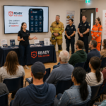
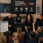
ReadyTakeAction Resilience In Action

The ReadyTakeAction App In Action


Mitigate & Prepare with Confidence
Get personalised risk insights, checklists, and guided property hardening and planning tools to strengthen your resilience.
Stay Informed & Safe
Receive real-time alerts, live mapping, incidence intelligence, and guidance to help you make informed decisions and protect what matters most.
Respond Safely
Be guided on how to respond to an emergency as it unfolds - when you need to activate your emergency plan, evacuate and connect with family - even when the towers have gone down.
Recover Stronger
Access recovery tools, document damage, claim insurance, find grants, and connect with community and recovery services - guided all the way.

Mesh Network & Emergency Nodes In Action
When the traditional communications towers fail and stop working, ReadyTakeAction activates its patent-pending mesh network, allowing users to continue communication when it's needed most.
Voices from the Community
Use Cases by Disaster Type
Select an emergency to see how ReadyTakeAction can be used in real-world disasters.
Bushfire Use
Overview - Before, During & After a Fast-Moving Fire
Before
Extreme fire danger warnings are issued for your region several days before conditions escalate. ReadyTakeAction helps you review your preparedness score, update your emergency plan, confirm evacuation routes, check your emergency kit, and ensure your household, pets, and emergency contacts are ready.
During
A nearby fire rapidly changes direction as weather conditions deteriorate. The platform aggregates live emergency warnings, incident intelligence, evacuation guidance, and road closures into one interface. Offline continuity tools help maintain access to critical information if communications fail.
After
Once the immediate threat passes, ReadyTakeAction helps you document damage, securely store evidence, begin insurance processes, access grants and recovery support, and coordinate recovery tasks for your household.
The real-world problem
Bushfires move faster than official warning systems. The decision to leave or defend is made in minutes, often without reliable information about fire location or behaviour.
How ReadyTakeAction helps
- The Planner generates property-specific action plans — not generic checklists, but plans built on the household's location, property type, access roads, and nearest evacuation points
- Live fire behaviour alerts cross-referenced with wind data push "Leave Now" triggers specific to each household's risk threshold — not the whole region
- Community incident feed aggregates real-time spotting reports, ember attack sightings, and road status from people on the ground — information that takes hours to reach official channels
- Emergency Nodes maintain communication in fire-affected areas where towers have been destroyed, enabling welfare tracking of isolated properties
- Post-fire, the recovery roadmap walks households through insurance claims, clean-up coordination, and grant applications
Who it's for
Households in high fire-risk zones, emergency services, volunteers, insurers, governments, local councils
Flood Use
Overview - Navigating Rapidly Rising Floodwaters
Before
Heavy rainfall forecasts and flood watches begin impacting your region. ReadyTakeAction provides preparedness guidance, sandbagging checklists, property protection recommendations, evacuation planning, and real-time flood intelligence tailored to your location.
During
Floodwaters rise quickly overnight, isolating roads and disrupting local infrastructure. The platform delivers evacuation alerts, live flood mapping, emergency updates, safe route guidance, and offline access to emergency plans and contacts.
After
As floodwaters recede, ReadyTakeAction supports cleanup coordination, damage documentation, insurance evidence collection, grant applications, and wellbeing support during recovery.
The real-world problem
Flood warnings are broad and late. By the time an official evacuation order is issued, roads are already cutting and families are making decisions blind.
How ReadyTakeAction helps
- Cross-references river gauge data and rainfall totals to push hyperlocal, property-specific alerts hours before official orders — giving families real decision time
- Community members post real-time road closure reports and water depth readings, building a live crowd-sourced flood map that outperforms official data on the ground
- When mobile towers flood, Emergency Node mesh keeps welfare check-ins and emergency coordination alive across isolated communities
- Post-flood, structured damage documentation with GPS-tagged photos is submitted directly in insurer-accepted format — before the claims queue overwhelms
Who it's for
Households in flood-prone catchments, emergency coordinators, insurers
Cyclone Use
Overview - Preparing for Landfall
Before
A tropical cyclone begins tracking toward your region. ReadyTakeAction helps you prepare through property checklists, emergency supply reminders, household planning, local emergency intelligence, and evacuation readiness workflows.
During
As destructive winds and power outages impact the area, the platform provides live emergency updates, shelter information, outage awareness, offline continuity access, and critical guidance during rapidly evolving conditions.
After
Following landfall, ReadyTakeAction assists with damage reporting, recovery planning, support services, debris cleanup coordination, and ongoing resilience support.
The real-world problem
Cyclones are the only disaster that guarantees telecommunications failure at the moment of greatest need. Every other system goes dark. The 24–72 hours post-landfall are blind.
How ReadyTakeAction helps
- 48-hour tiered pre-landfall alert sequence — "Prepare Now" → "Consider Early Departure" → "Final Departure Window Closing" — matching how families actually make decisions under escalating threat
- Category 4-rated Emergency Nodes are purpose-built to survive the event itself. Solar-powered, self-forming mesh. When every tower falls, the nodes keep running
- Welfare check-ins via mesh create a real-time survival map — who has checked in safe, who has flagged assistance needed, who hasn't responded — giving rescue authorities a priority list before they can physically access the area
- Vulnerability flags (elderly, medical, disability) built into profiles automatically sort the welfare list — emergency services don't have to make that call in chaos
- Post-landfall, multilingual recovery coordination supports seasonal worker and multicultural communities underserved by English-only official channels
Who it's for
Cyclone-prone households and communities, emergency and rescue services, aged care providers
Storm Use
Overview - Severe Weather & Infrastructure Disruption
Before
Severe thunderstorm warnings are issued with risks of destructive winds, flash flooding, hail, and blackouts. ReadyTakeAction helps you secure your property, prepare backup supplies, review emergency contacts, and monitor evolving conditions.
During
Power and communications begin failing across multiple suburbs. The platform delivers emergency alerts, outage updates, live weather intelligence, offline access to plans and contacts, and guidance to help keep your household safe.
After
ReadyTakeAction helps coordinate cleanup, document storm impacts, connect with support services, and track ongoing recovery actions.
The real-world problem
Severe storms can give 10–20 minutes of real warning. In that window, most people don't know what to do. After the storm, simultaneous insurance claims overwhelm every insurer at once.
How ReadyTakeAction helps
- Real-time radar integration pushes suburb-specific alerts with estimated time-to-impact — "Large hail reaching your suburb in 12 minutes" — not a generic Greater Area warning
- That 12-minute window is enough to move vehicles, bring in outdoor furniture, and get children away from windows — three actions that collectively prevent hundreds of thousands in damage
- Post-storm, the damage documentation tool captures timestamped, GPS-tagged photos in insurer-accepted format within hours of impact — before the claims queue blows out to 6–8 weeks emergency service triage is supported by the community incident feed — crowd-sourced damage concentration data helps 600 volunteers deploy like 6,000
Who it's for
Urban and suburban households, insurers, emergency services
Earthquake Use
Overview - Immediate Response When Seconds Matter
Before
In earthquake-prone regions, ReadyTakeAction supports preparedness through emergency planning, household safety guidance, emergency kit management, and training modules focused on rapid response readiness.
During
An earthquake strikes with little warning. The platform provides immediate safety guidance, emergency contacts, situational updates, and offline access to critical information during infrastructure disruption.
After
Following the event, ReadyTakeAction supports welfare check-ins, damage documentation, recovery coordination, assistance pathways, and community support engagement.
The real-world problem
Earthquakes provide zero warning. The disaster is over in 60 seconds. What follows is 72 hours of structural uncertainty, communication disruption, and welfare unknowns — with no clear picture of who is injured, trapped, or isolated.
How ReadyTakeAction helps
- Immediately post-event, ReadyTakeAction pushes a "Check In Safe" prompt to all households in the affected radius — creating a rapid welfare map within minutes
- Households that don't check in within 30 minutes are automatically flagged to family members and emergency coordinators — turning a chaotic unknown into a prioritised list
- Community incident feed aggregates real-time structural damage reports — collapsed walls, gas leaks, road damage, unsafe buildings — information that takes hours to reach official channels
- Emergency Nodes provide communication in areas where the earthquake has destroyed tower infrastructure
- Evacuation route mapping accounts for real-time road damage reported by the community — redirecting residents away from compromised routes before official closures are published
- Post-event, damage documentation supports insurance claims and structural assessment prioritisation, helping councils allocate building inspectors to the highest-risk properties first
Who it's for
Earthquake-prone households and communities, emergency service and rescue authorities, building regulators, insurers
Heatwave Use
Overview - Managing Extended Extreme Heat
Before
An extended heatwave is forecast with elevated health and bushfire risks. ReadyTakeAction delivers preparedness reminders, hydration guidance, vulnerable person check-ins, cooling centre locations, and local hazard intelligence.
During
As temperatures intensify and energy infrastructure becomes strained, the platform provides emergency health guidance, outage information, community support coordination, and live emergency updates.
After
ReadyTakeAction helps communities recover through wellbeing resources, support services, resilience planning, and preparedness improvements for future events.
The real-world problem
Heatwaves can kill more people than any other disaster. The victims are elderly, isolated, and invisible — no emergency services are dispatched, no insurance claims are made, no media coverage runs. They die alone in hot rooms, and nobody knew to check.
How ReadyTakeAction helps
- Risk assessment flags high-vulnerability households — elderly, disability, single-person, no air conditioning — before the season begins
- Family Tracker connects adult children to elderly parents' welfare status without requiring the elderly person to actively use technology
- Daily "Heat Check" — a single tap by 11am. If it doesn't happen, family members and community welfare volunteers are automatically alerted
- Cool Refuge locations — libraries, community halls — are mapped in real time with air-conditioned hours, redirected during power outages to locations still on-grid
- During rolling load shedding, suburb-specific outage alerts and nearest powered refuge directions push instantly
- Community mutual aid network connects residents with spare cool space to isolated neighbours without transport
Who it's for
Elderly residents, their families, local councils, health departments, aged care providers
Tsunami Use
Overview - Seconds Matter When the Coastline is at Risk
Before
Following a major offshore earthquake, tsunami advisories are issued for coastal regions. ReadyTakeAction provides evacuation guidance, coastal risk information, emergency route planning, and preparedness actions tailored to your location.
During
As warnings escalate, the platform delivers real-time tsunami alerts, evacuation zone intelligence, safe route guidance, shelter information, and offline access to critical emergency information during rapidly evolving conditions.
After
Once the immediate threat passes, ReadyTakeAction supports welfare check-ins, damage documentation, recovery coordination, assistance pathways, and community recovery support for affected coastal communities.
The real-world problem
Tsunami warning windows are measured in minutes for near-source events. The difference between a timely evacuation and a catastrophic casualty event is whether coastal communities receive a clear, actionable instruction — and whether they move immediately.
How ReadyTakeAction helps
- Integration with warning centres enables instant push alerts to all coastal households in the inundation zone — with specific instructions based on their distance from shore and elevation
- Pre-built tsunami action plans specify each household's nearest high-ground evacuation point and route — decisions that cannot be made in real time during a 12-minute window
- Community incident feed provides real-time road status as evacuation routes become congested or blocked
- For near-source events, the alert sequence triggers immediate departure instructions without waiting for official confirmation — in a near-source tsunami, waiting for confirmation means waiting until it's too late
- Post-event, welfare check-in maps identify which coastal properties have not confirmed safe — critical for search and rescue prioritisation in inundated zones
Who it's for
Coastal households and communities, emergency and rescue authorities, tourism operators
Volcano Use
Overview - Complex and Prolonged Disaster Timeline
Before
Most volcanic casualties and losses are preventable with pre-event preparation, yet most households in high-risk zones have no structured plan. ReadyTakeAction changes that.
During
Volcanic eruptions are uniquely hostile to digital infrastructure. Ash shorts out equipment, weight collapses communication towers, and toxic gas forces indoor shelter. ReadyTakeActionTA is designed to keep working exactly when conventional apps cannot.
After
Recovery from volcanic events is slow, expensive, and frequently contested by insurers unfamiliar with ash damage, structural loading failures, and contamination timelines. ReadyTakeAction creates the evidentiary trail that makes recovery faster and fairer.
The real-world problem
When a volcano stirs, communities face one of the most complex and prolonged disaster timelines of any natural hazard. Unlike a storm that passes in hours, volcanic emergencies can unfold over days, weeks, or months — with shifting hazard zones, compounding ash accumulation, toxic gas releases, and evacuation orders that keep changing.
How ReadyTakeAction helps
- Risk zoning awareness — users can store their volcanic hazard zone (VEZ 1–6 in NZ, similar in Indonesia/Philippines) in their profile and get zone-specific action plans
- Property hardening — ash ingress protection (seal gaps, air filters), roof load assessment (ash weight per m² can collapse structures), water supply contamination planning
- Emergency kit customisation — N95/P2 masks, goggles, plastic sheeting, pre-filled water containers, livestock plans for farming communities
- Evacuation route planning — lava flow paths make certain roads permanently cut off; alternate routes need to be pre-mapped
- Family/community welfare links — eruptions often displace communities for weeks/months, not hours
- Mesh networking — ReadyTakeAction's mesh comms feature is specifically suited to volcanic emergencies where cell towers fail under ash load
- Community check-ins — welfare monitoring for elderly/isolated residents sheltering in place during ashfall
- Damage documentation — ash damage, roof collapse, contamination of water tanks, crop loss Insurance evidence vault — pre-event photos of property + post-event timestamped damage photos = strong claims
- Recovery roadmap — decontamination sequence, livestock recovery, psychological impact (displaced communities)
- Grant finder — volcanic events trigger government disaster declarations and specific recovery payments
- Mental health and community recovery — displacement for weeks or months causes significant psychological harm; ReadyTakeAction's integrated mental health check-ins, peer support network, and community hub keep social fabric intact during the long tail of recovery
Who it's for
Volcanic communities, emergency management services, governments, insurers
Landslide/Mudslide Use
Overview - Compounding, Dangerous, and "Silent" Hazards
The Nature of the Hazard
Mudslides and landslides are among the most deceptive natural hazards because they are rarely the first disaster — they are the disaster that follows the disaster. Communities already in recovery mode, already exhausted and resource-depleted, face a second catastrophic event with almost no warning.
Before - The Warning Gap
No warning system
No dedicated early warning system exists in most of the world equivalent to a weather bureau cyclone or flood warning infrastructure. There is no "Landslide Watch" broadcast network.
Risk is invisible until it isn't.
A slope that has held for decades can fail within hours of a fire burning its vegetation or rainfall saturating its soil. Most residents have no idea their property sits in a debris flow path.
Post-fire slopes are a time bomb.
Burned catchments lose 70–90% of their water absorption capacity. The first significant rainfall after a fire can trigger debris flows on slopes that never moved before — sometimes months or years after the fire.
Evacuation route vulnerability is unmapped.
Most household emergency plans assume road access. Very few communities have pre-identified what happens when the only road out is the slide path.
Insurance blind spots.
Many homeowners don't know whether their policy covers landslide (it usually doesn't — it's typically excluded from both home and flood policies as a separate "earth movement" event).
No community-level risk awareness.
Neighbours don't know who lives on the slope above them, whether upstream drainage is blocked, or whether a property has had slope stabilisation done.
During - The Rapid Onset Crisis
Minutes, not hours.
A debris flow can travel at 30–60 km/h. The window between first movement and impact on a structure below can be under two minutes. There is no time to receive, process, and act on a traditional alert.
Roads fail first.
The primary escape route and the primary emergency services access route are typically the same road — and it is typically in the slide path. When the slope moves, the road goes with it. Simultaneously.
Communications fail with the road.
In most of areas, fibre backhaul runs alongside the road corridor. When the road is severed, the cable is severed. When the cable is severed, all carriers dependent on that backhaul lose connectivity — simultaneously. There is no one left to call and no way to call them.
Emergency services can't reach you.
Fire, ambulance, and rescue vehicles cannot access a community behind a debris flow. Response times go from minutes to hours or days — depending entirely on when heavy machinery can clear the route.
Secondary slides follow.
The initial event destabilises surrounding material. Rescue and access attempts can trigger further movement. Emergency services sometimes cannot safely enter the affected area for extended periods.
Structural failure is non-linear.
A house hit by a debris flow doesn't just flood — it can be partially or fully demolished, trapping occupants under structural debris mixed with mud, rock, and water simultaneously.
Night events are the most deadly.
Many landslide fatalities have occurred at night, when visual warning signs are invisible, and residents are asleep.
After - The Compounding Recovery Problem
A significant debris flow across a single-lane mountain road can require weeks of heavy machinery work before the road is passable — even for emergency vehicles. Communities can remain genuinely isolated.
The "missing person" problem is acute.
Without communications, it is impossible to know who was caught in the slide, who evacuated safely, and who is trapped and alive. Welfare checking across an isolated community with no comms is effectively impossible through conventional means.
Insurance disputes are extremely common.
"Earth movement" exclusions, flood vs. landslide causation arguments, and the difficulty of documenting damage in an inaccessible area combine to make landslide insurance claims among the most contested of any natural hazard. Claims take years, not months.
Contamination follows.
Debris flows carry everything the slope has accumulated — agricultural chemicals, septic waste, fuel, asbestos from older structures, industrial materials. Properties "cleaned up" after a mudslide may have serious contamination that isn't assessed or disclosed.
Mental health load is disproportionate.
Survivors of rapid-onset events (compared to slow-onset floods) show higher rates of acute stress and PTSD. The randomness — why this house and not that one — combined with the speed of the event and the extended isolation of recovery creates a distinctive and severe psychological burden.
Repeat risk is higher than most realise.
A slope that has failed once has already demonstrated the failure mode. The drainage, vegetation, and structural profile that caused the first slide are often still present — or made worse by the event itself. Rebuild decisions are often made without adequate geotechnical assessment.
Government recovery programs lag.
Disaster recovery funding arrangement activations often take weeks to formalise after landslide events, particularly for events that aren't declared alongside a named storm or flood — leaving individuals without access to emergency payments during the most acute period.
The single consistent amplifier of harm across before, during, and after is the same one that defines all of ReadyTakeAction's work: when the road fails, the communications fail with it. Unlike fires (where aerial assets can still operate) or floods (where boats can reach people), landslides create a physical barrier that severs both physical access and communications infrastructure simultaneously — and often cannot be cleared quickly. The community on the other side is, in the most literal sense, cut off from the world.
The real-world problem
The combination of:
- Rapid onset (minutes, not hours)
- Road and bridge severance isolating communities
- No dedicated early warning system in most of the world
- Communications infrastructure destroyed along with access routes ...makes mudslides one of the most dangerous "silent" hazards in the Ready Take Action context.
How ReadyTakeAction helps
The critical insight for landslides/mudslides specifically is the road severance + comms severance combination.
When a slide cuts the road, it usually also severs the fibre running alongside it. ReadyTakeAction's mesh network — operating independently of that infrastructure — is often the only remaining communications link between an isolated community and the outside world.
- Checklist: burn scar assessment, slope angle, drainage, evacuation route pre-identification
- Community hazard reporting — members flag unstable slopes, drainage blockages, erosion
- Pre-set evacuation routes with alternate paths if primary road is blocked
- Emergency kit includes specific mudslide items (rope, waterproof bag, go-bag on high shelf)
- Family action plan includes vertical evacuation trigger points
During
- Real-time weather bureau rainfall intensity alerts cross-referenced with slope risk data
- Community incident reports propagate via mesh — road blocked, slope moving, escape route cut
- SOS with GPS for trapped residents
- Welfare check-ins via mesh when roads (and therefore emergency services access) are severed
- Evacuation coordination when primary routes are already blocked — alternate route push notifications
- Mesh communications remain operational when road severance cuts all tower backhaul
After
- Damage documentation with geo-tagged photos for insurance and council/state recovery claims
- Road and access reporting — community updates on which routes are passable
- Assistance requests — debris removal, structural assessment, temporary accommodation
- Recovery roadmap with relevant grants
- Mental health check-ins — landslides/mudslides carry high trauma load, especially as secondary disasters
- Community coordination for volunteer clean-up events
Who it's for
Landslide/Mudslide risk communities, emergency management services, governments, insurers
Drought Use
Overview - Building Resilience During Prolonged Dry Conditions
Before
Long-term rainfall deficiencies and worsening seasonal forecasts begin increasing drought risk across your region. ReadyTakeAction provides water conservation guidance, preparedness planning, agricultural resilience information, livestock and property management support, and local risk intelligence tailored to evolving conditions.
During
As drought conditions intensify, the platform delivers updates on fire danger, water restrictions, heatwave risks, financial assistance programs, wellbeing resources, and community support services. Households, farmers, businesses, and communities can access guidance designed to support operational continuity and resilience during extended dry periods.
After
When conditions begin improving, ReadyTakeAction helps users access recovery grants, financial support pathways, mental health resources, rebuilding assistance, and long-term resilience planning tools designed to strengthen preparedness for future climate and drought impacts.
The real-world problem
Drought is a slow disaster. It arrives without a single trigger event, affects rural and agricultural communities first, and by the time it reaches public awareness, the damage — financial, psychological, community — has already accumulated over years. No emergency service is dispatched. No insurer pays. Farming families deteriorate in silence.
How ReadyTakeAction helps
- ReadyTakeAction's drought risk profile monitors seasonal rainfall deficiency data and flags households in declared drought areas with relevant support pathways — before crisis point
- The Grant Finder aggregates federal and state drought assistance payments, farm household allowance, rural financial counselling access, and water infrastructure subsidies — in one place, updated in real time
- Mental health resource integration connects isolated rural households with services — with proactive prompts tied to drought severity, not just user-initiated searches
- Community Hub enables rural mutual aid networks — hay runs, agistment sharing, water carting coordination — between properties that would otherwise never connect
- Business Continuity Planner helps farm businesses model reduced-income scenarios and identify operational adaptations before they become insolvency events
- Recovery Roadmap provides post-drought restocking and financial recovery pathways once conditions improve
Who it's for
Rural and agricultural households and communities, farming communities, rural financial counsellors, mental health services
Multi-Hazard Use
Overview - When Multiple Emergencies Overlap
Before
Severe weather conditions create heightened risks across multiple hazards, including flooding, storms, and infrastructure disruption. ReadyTakeAction helps households and organisations prepare for cascading impacts through guided planning and operational awareness.
During
As conditions evolve, the platform aggregates alerts, incident intelligence, outage information, evacuation guidance, and operational updates into one connected resilience environment.
After
Recovery support pathways help users navigate insurance, damage documentation, financial assistance, wellbeing support, and preparedness improvements for future events.
The real-world problem
The worst disaster events are rarely singular. For example, the 2019–20 Black Summer in Australia combined drought, extreme heat, bushfire, and smoke across multiple states simultaneously. Emergency services, government systems, and community support networks were designed for one disaster at a time. Compounding events break every assumption those systems were built on.
How ReadyTakeAction helps
- ReadyTakeAction's platform is disaster-type agnostic — the same household profile, action plan, welfare check-in, and Emergency Node infrastructure functions across all disaster types simultaneously During a compounding event, the dashboard surfaces all active threats simultaneously — a household on the urban fringe might face bushfire risk to the west, flood risk from storm rainfall to the east, and power outage risk from grid overload — ReadyTakeAction shows all three
- Priority triage logic across multiple active incident feeds — when a community is managing simultaneous crises, ReadyTakeAction's vulnerability-weighted welfare system doesn't break down; it filters by most urgent need across all active events
- Emergency Nodes remain operational regardless of the disaster type causing infrastructure failure — the mesh doesn't care whether the tower fell to fire, flood, or cyclone
- Post-event, the recovery coordination hub handles multiple claim types simultaneously — fire damage, flood damage, and business interruption in the same interface, without requiring households to navigate different agencies for each
Who it's for
High-risk zone households, emergency management agencies, state and federal government coordinators
Pandemic Use
How ReadyTakeAction helps
- ReadyTakeAction's vulnerability register — already populated for heatwave and disaster preparedness — immediately identifies households requiring welfare support under pandemic conditions without requiring re-registration
- Daily welfare check-in system functions identically in pandemic conditions — family members and community volunteers are alerted to non-responsive high-vulnerability households
- Community mutual aid coordination operates without physical proximity requirements — grocery delivery matching, medication collection, telehealth access support, and financial hardship referrals through the community hub
- The Grant Finder aggregates pandemic-specific support payments — JobKeeper-equivalent programs, rental assistance, small business grants, mental health telehealth subsidies — as they are announced
- Multilingual alert and information distribution reaches culturally and linguistically diverse communities underserved by English-only official health communications
- Emergency Nodes provide communication redundancy for communities where internet access is unreliable — ensuring welfare monitoring functions even in low-connectivity regional and remote areas
Who it's for
High-vulnerability households, aged care providers, local councils, state health departments, multicultural community organisations
Community Recovery Use
Overview - Recovery Beyond the Emergency
Before
Community organisations, volunteers, and households prepare recovery plans and resilience networks before disaster seasons begin.
During
As emergency response operations continue, ReadyTakeAction supports community coordination, assistance requests, volunteer engagement, and shared situational awareness.
After
Long after the disaster has passed, the platform helps coordinate grants, donations, recovery tasks, insurance processes, mental health support, rebuilding activities, and long-term community resilience initiatives.
The real-world problem
When the emergency phase ends, the support structure largely disappears. Emergency services stand down, media moves on, and thousands of households are left navigating insurance claims, rebuilding decisions, grant applications, and emotional recovery — simultaneously, alone, without a roadmap.
How ReadyTakeAction helps
- The Recovery Roadmap activates automatically post-event — a structured, stage-by-stage guide that walks households from immediate response through medium-term repair and long-term rebuilding, without requiring them to know what comes next
- Grant Finder aggregates every available federal, state, and council recovery payment in real time — disaster recovery allowances, essential household contents grants, structural repair subsidies, small business funds — updated as programs are announced and de-duplicated across agencies
- Damage documentation captured during the event becomes the evidence base for insurance claims, government assessments, and rebuilding permits — one structured record, used across multiple processes
- Community Hub activates as a local recovery coordination layer — matching volunteers with households that need help, organising clean-up events, and enabling mutual aid matching across neighbouring properties
Who it's for
Disaster-affected households, local councils, state recovery agencies, volunteer coordinators
Rebuilding Coordination
The real-world problem
After a major disaster, the rebuilding pipeline — trades, materials, inspectors, permits — gets overwhelmed simultaneously. Vulnerable households with less social capital, less financial literacy, and less English proficiency fall to the bottom of every queue. Scammers targeting disaster-affected communities emerge within 48 hours of every major event.
How ReadyTakeAction helps
- Rebuilding Coordination hub connects households with vetted local tradespersons — builders, electricians, plumbers, roofers — who have been pre-verified by the community platform, reducing exposure to disaster chasers and price gouging
- Stage-gated rebuilding checklist walks households through permit requirements, structural assessment priorities, and insurer approval steps in the correct sequence — preventing costly mistakes from work commenced before approval
- Multilingual support ensures CALD (culturally and linguistically diverse) households receive the same quality of rebuilding guidance as English-speaking households — reducing the equity gap that consistently widens post-disaster
- Community forum surfaces real-time tradesperson availability and pricing — crowd-sourced, transparent, and updated as supply normalises
Who it's for
Disaster-affected households and communities, councils, state building regulators, community legal centres
Volunteer Mobilisation
The problem
After every disaster, thousands of people want to help. They show up at evacuation centres, call recovery networks and charities, and post on Facebook — but there is no coordination infrastructure to match willing volunteers with actual need. The result is simultaneous volunteer overflow in accessible areas and volunteer absence in isolated communities.
How ReadyTakeAction helps
- Volunteer registry captures skills, availability, equipment, and geographic reach for every registered volunteer in the affected region — not just "willing to help" but what they can do, with what tools, in which areas
- Real-time task matching connects specific household needs — roof tarping, debris removal, fence rebuilding, animal rescue, meal delivery, welfare checks — with volunteers holding the relevant skills and equipment
- Clean-up and recovery events are coordinated through ReadyTakeAction's event system — with registered attendance, equipment lists, safety briefings, and completion tracking Isolated community reach — volunteers with 4WD, boats, or aircraft are identified and matched to communities that ground-based volunteers cannot access
- Post-event, volunteer hours and activities are automatically compiled into impact reports used by councils and state agencies to demonstrate community contribution and unlock future funding
Who it's for
Individual volunteers, volunteer coordinators, recovery agencies and charities, local councils
Community Peer Support
The real-world problem
Disaster-affected communities carry a collective trauma that professional mental health services are not resourced to address at scale. The psychological recovery of a community happens primarily through human connection — neighbour to neighbour, story to story — and the platforms that facilitate that connection are designed for entertainment, not recovery.
How ReadyTakeAction helps
- Community Hub provides a dedicated, trusted, non-commercial space for disaster-affected communities to share experiences, ask questions, and offer support — without algorithms surfacing distressing content for engagement
- Peer support matching connects residents who have been through a previous disaster of the same type with those going through it for the first time — structured, opt-in mentoring built into the community layer
- Mental Health Hub integrates proactive wellbeing prompts triggered by recovery stage markers — not just "here is a helpline" but contextual prompts at 2 weeks, 6 weeks, 3 months post-event when distress commonly peaks
- Success stories from the recovery process are visible within the community feed — reducing isolation and demonstrating that recovery is possible, which is itself a critical protective factor
- Moderated, safe space — community posts are monitored and managed within the platform, preventing misinformation, blame, and the kind of community fracture that social media platforms routinely amplify post-disaster
Who it's for
Disaster-affected residents, mental health services, local councils
School and Family Recovery
The real-world problem
Children are disproportionately affected by disaster trauma, and schools are often the most important stabilising institution in a disaster-affected community — yet they operate entirely separately from the emergency management and community recovery infrastructure.
How ReadyTakeAction helps
- School Connect links school communities directly into the ReadyTakeAction platform — enabling schools to communicate with families during the emergency phase, coordinate student welfare checks, and manage attendance when students are displaced
- Post-disaster, the platform supports family welfare monitoring across the school community — teachers can see which of their students' families have not checked in, enabling targeted pastoral follow-up
- Recovery resources for schools are built into the platform — structured guidance for teachers on trauma-informed communication, student wellbeing monitoring, and community re-engagement activities
- Family Tracker enables displaced families to maintain connection across evacuation centres, temporary accommodation, and permanent housing transitions — critical for children's sense of stability during a chaotic period
- Student return coordination — as families return to affected areas at different times, School Connect allows schools to manage a rolling return of students to classroom learning
Who it's for
Schools, parents, education departments, child welfare services
Small Business Recovery
The real-world problem
Small businesses are the economic backbone of disaster-affected communities — and the most vulnerable to extended closure. Insurance claims are complex. Staff are displaced. Supply chains are broken. And the business owner is simultaneously managing their own household's disaster response while trying to keep the business viable.
How ReadyTakeAction helps
- Business Continuity Plan — built pre-disaster through ReadyTakeAction's assisted planner — activates during the event with clear, pre-made decisions about alternate operating locations, staff communication protocols, and critical function priorities
- Grant Finder surfaces every available small business recovery payment — federal business grants, state disaster recovery loans, local council emergency relief, industry-specific assistance — in one place
- ReadyTakeAction's damage documentation tool captures business asset damage, stock loss, and structural damage in a format accepted by commercial insurers — accelerating claim processing
- Staff welfare coordination — the platform helps business owners track which staff are safe, displaced, or themselves in crisis, enabling appropriate rostering decisions and welfare referrals
- Community Hub connects affected businesses with community purchasing campaigns — buy-local initiatives that drive revenue back to impacted Main Streets in the weeks and months post-event
- Recovery timeline benchmarking shows business owners where they sit against typical recovery milestones, reducing the isolation of not knowing whether their experience is normal
Who it's for
Small business owners, chambers of commerce, state business recovery agencies, commercial insurers
Long-Term Community Resilience
The real-world problem
Disaster recovery is measured in months on official timelines and years in community experience. The structures built during the acute recovery phase — volunteer networks, community connections, shared knowledge — dissolve once funding ends and attention moves on. The next disaster finds the community no better prepared than the last one.
How ReadyTakeAction helps
- Lessons Learned tool captures structured community feedback from each event — what worked, what failed, what resources were missing — and feeds that back into updated action plans and community preparedness protocols
- Community groups formed during recovery are maintained within ReadyTakeAction's platform — they don't disappear when the acute phase ends, they become the preparedness infrastructure for next time
- Resilience scoring at household and community level tracks preparedness progress over time — identifying gaps before the next event arrives and creating visible, measurable improvement that motivates continued engagement
- Post-disaster volunteers who engaged during recovery are retained in the volunteer registry — their skills, equipment, and willingness documented, ready to be activated for the next event without starting from scratch Intergenerational knowledge transfer — success stories, community lessons, and local knowledge accumulated through the recovery process are preserved in the community platform, outlasting individual memory and leadership changes
Who it's for
Local councils, state emergency management agencies, community organisations, long-term disaster recovery coordinators
One Ecosystem.
Every Connection.
ReadyTakeAction connects the people, organisations and systems that keep communities safe and resilient.

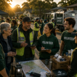


Building resilience together.
Hundreds of Connected Capabilities
Powerful tools and features designed for every stage of disaster resilience.
Built for When Infrastructure Fails
Disasters can disrupt power, internet and mobile networks. ReadyTakeAction is built with offline-first technology and mesh networking to keep you connected when it matters most.
Designed for a Changing World
Built for Australia. Designed for the world.
Australia's app is set to launch publicly in July 2026, with global expansion already underway.